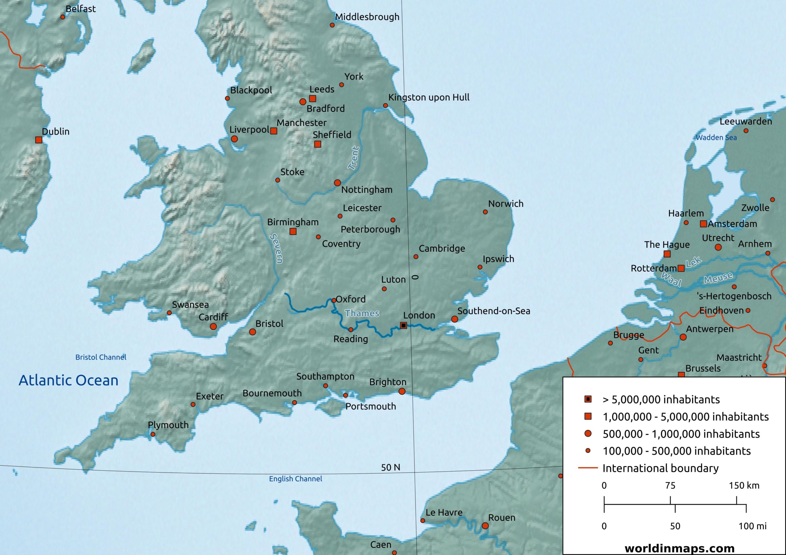
The River Thames
| Location | |
| Country | UK |
| Cities | London, Oxford, Reading, Windsor |
| Physical characteristics | |
| Sources | |
| Thames Head | |
| Location | Gloucestershire (UK) |
| Elevation | 110 m (360 ft) |
| Ullenwood | |
| Location | Gloucestershire (UK) |
| Elevation | 214 m (702ft) |
| Mouth | |
| Thames Estuary (North Sea) | |
| Location | Southend-on-Sea (Essex, UK) |
| Elevation | Sea level |
| Length | 346 km (215 mi) |
| Basin size | 12,935 km² (4,994 sq mi) |
| Discharge | |
| Location | Average |
| London | 65.8 m³/s (2,320 cu ft/s) maximum: 370 m³/s (13,000 cu ft/s) |
| Entering Oxford | 17.6 m³/s (620 cu ft/s) |
| Leaving Oxford | 24.8 m³/s (880 cu ft/s) |
| Reading | 39.7 m³/s (1,400 cu ft/s) |
| Windsor | 59.3 m³/s (2,090 cu ft/s) |
The River Thames is located in the Southern of England (UK). The river is about 346 km (215 mi) length and it is the longest river entirely in England and the second longest in the UK.
It is a major trade route for international trade with the Port of London and the UK system of canals.
Human activity has used the Thames for thousands of years for its water, food, and energy.
The strategic position of the river has made it a central place in the history of England and the United Kingdom.
Thames River map