Weather and Climate | Home / Weather and Climate / The types of clouds and their characteristics
The types of clouds and their characteristics
Clouds are in meteorology visible masses made of a big quantity of liquid droplets and /or frozen crystals suspended in the atmosphere. These clouds are formed by very small droplets of water and / or ice crystals (2 to 200 microns in diameter) obtained by the condensation of water vapor from the atmosphere around tiny particles (dusts, aerosols, …) called condensation nuclei.
The aspect of a cloud is characterized by its form, texture, opacity and colors. These parameters vary in function of the constituent of the cloud and the atmospheric conditions.
Table of contents
- How are clouds classified
- The 10 basic cloud types (genera)
- The 14 species of clouds
- The 9 varieties of clouds
How are clouds classified
The international classification uses the families, genera, species and varieties. This is similar to the classifications use for plants and animals and like these classifications, Latin names are used.
The nomenclature is based on 4 Latin names depending on the characteristics of the cloud.
| Names | Characteristics |
|---|---|
| Cumulus | rounded form |
| Cirrus | fibrous form |
| Stratus | layer without a specific form |
| Nimbus | accompanied by rain |
These names can be associated to define the different clouds of the classification.
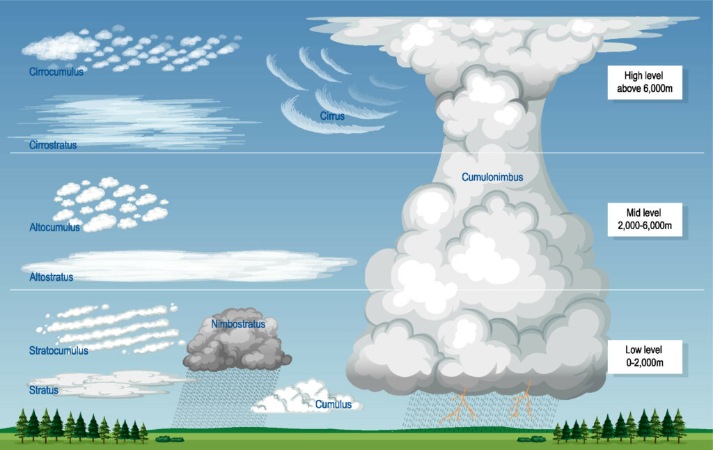
In total the World Meteorological organization recognized currently 10 genera that are group in 4 families. Theses families correspond to 3 different altitudes intervals of the troposphere and 1 family for the clouds with high vertical development across the 3 different layers.
The 10 basic cloud types (genera)
| Family | Genera (name and symbol) |
|---|---|
High clouds (ice)
| Cirrus (Ci) |
| Cirrocumulus (Cc) | |
| Cirrostratus (Cs) | |
Middle level clouds (liquid water / ice)
| Altocumulus |
| Altostratus (As) | |
| Nimbostratus (Ns) | |
Low clouds
| Stratocumulus (Sc) |
| Stratus (St) | |
Towering vertical
| Cumulus (Cu) |
| Cumulonimbus (Cb) |
Cirrus (Ci)
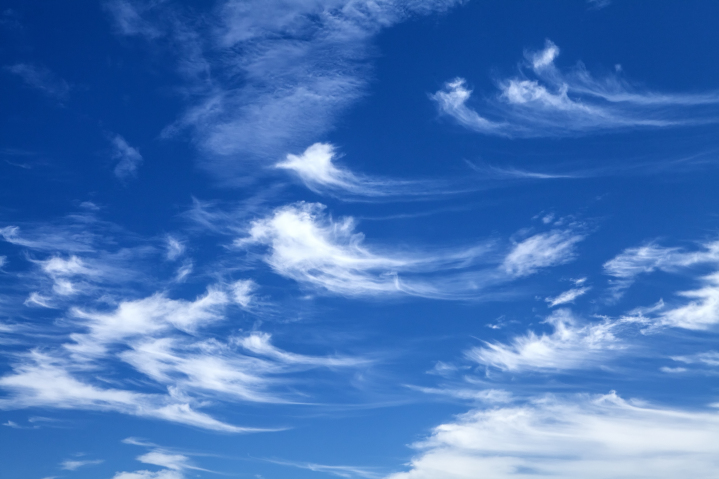
These are fibrous wisps of delicate white ice crystal clouds. They can be found in large fields or in narrow white bands. Sightly opaque, sunlight can pass through it. These clouds are pink or red after the sunset. These clouds don’t produce precipitation.
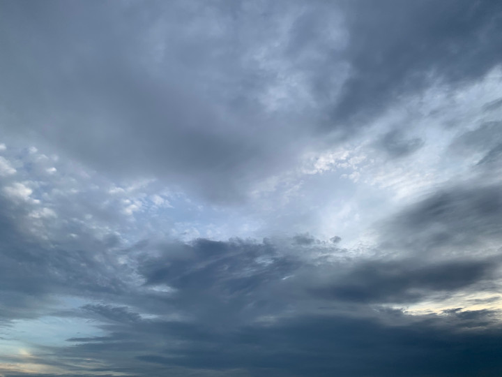
Cirrostratus (Cs)
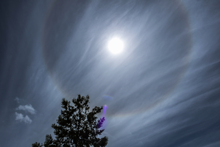
These clouds are made of ice crystal and it forms a translucent whitish veil completely or partially covering the sky. These clouds are often accompanied by a halo phenomenon. This type of cloud also don’t produce precipitation, but it announces the arrival of a depression.
Cirrocumulus (Cc)
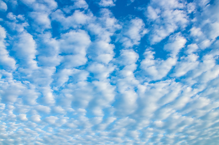
These clouds are rarely observed. They are shaped like a cotton flower and very small. They are composed of ice crystals or supercooled water droplets. These clouds are non-precipitating, but they can indicate the arrival of a front.
Altostratus (As)
These clouds are stratifom and they are present in layers in which the limits are difficult to define. They form a broad gray, slightly streaked or fibrous layer. They let light diffuse without a visible shadow on the ground. They have a thickness of 500 m to 3 000 m (1,650 ft to 10,000 ft). They are composed of water droplets, but it may be mixed with ice crystals at higher altitudes. Widespread opaque altostratus can produce light continuous or intermittent precipitation (rain or snow). These clouds are relative to a stable air.
Altocumulus (Ac)
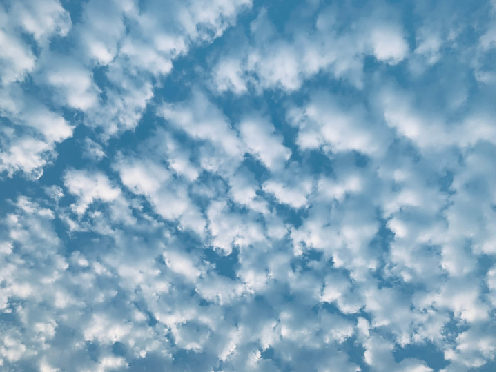
These clouds are in the form of lamellae, pebbles, rolls with a sometimes partially fibrous or fuzzy appearance. They may or may not be welded. They are white and / or gray and they appear as a bank, in a sheet or in a layer. These clouds usually have their own shadow, which helps distinguish them from cirrocumulus clouds.
Stratus (St)

These clouds are characteristic grayish in color and have a fairly uniform appearance. They are sometimes made up of separate elements with a jagged appearance. They are often accompanied by a hazy atmosphere. They are also likely to give off drizzle (precipitation of very fine droplets of water or granulated snow (diameter less than one millimeter)). This type of cloud can result from nighttime cooling, the influx of humid air from a lake, sea or ocean, evaporation above a body of water or after heavy rain.
Stratocumulus (Sc)
This type of cloud appears as a large, dark, rounded mass. Individually, each cloud is bigger than an altocumulus cloud. They are usually present in groups, lines or waves. This type of cloud has a convective origin, but the vertical extension is immediately limited by the stability of the upper layer.
Cumulus (Cu)
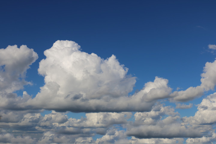
This type of cloud is loose, normally dense, and budding in appearance (cauliflower-shaped) with a small vertical extension. This type of cloud occurs during convection following an adiabatic expansion. They can form in many types of situation, but often following the passage of a disturbance (the cold front moves away and the sun becomes visible again, which causes the ground to warm).
Cumulonimbus (Cb)
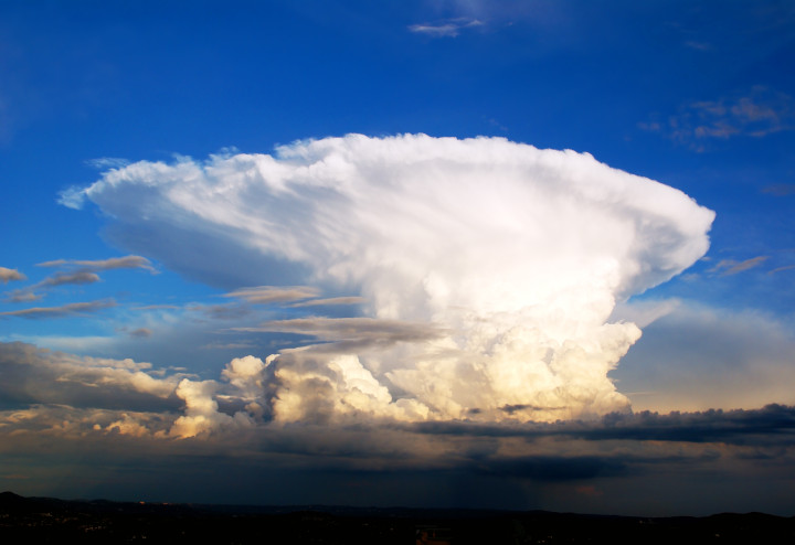
This type of cloud is dense with a very high vertical extension (the highest). It is of convective origin. The top has the shape of an anvil. This cloud is the source of thunderstorms and it generally develops as a cold front approaches.
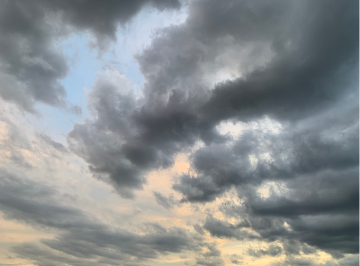
Nimbostratus (Ns)
This cloud is stratiform with a significant vertical extension. It is often made up of several layered layers without a defined shape and dark gray in color. It also completely hides the sun. It produces low to moderate precipitation, but over large areas.
The 14 species of clouds
The 10 genera of clouds are the top classification, but most of the genera are subdivided into species due to the particularity in shape. A species can belong to more than one genera of cloud. One genera can have more than one species and some genera have no species. The species are mutually exclusive, in other word a cloud can be assigned to only one species.
| Species | Description | Genera |
|---|---|---|
| Fibratus | Detached clouds or a fine veil consisting of almost straight or more or less irregularly curved filaments and they do not end in hooks or tufts. | Cirrus and cirrostratus |
| Uncinus | Cirrus usually comma-shaped terminating in its upper part in a hook or tuft and the upper end of which is not in the form of a rounded protuberance. | Cirrus |
| Spissatus | Cirrus clouds thick enough to be gray when viewed near the sun. | Cirrus |
| Castellanus | Clouds which present in their upper part protuberances in the form of towers and which give them a crenellated appearance. The towers come from the same base and they are arranged in a line. | Cirrus, cirrocumulus, altocumulus and stratocumulus |
| Flocus | Each cloud is a tuft of cumuliform appearance, the base of which is more or less jagged and which is often accompanied by virga (observable streak or shaft of precipitation falling from a cloud that evaporates or sublimates before reaching the ground). | Cirrus, cirrocumulus and altocumulus |
| Stratiformis | Clouds that extend in a large sheet or horizontal layer. | Stratocumulus, altocumulus and sometimes cirrocumulus |
| Nebulosus | Clouds in the form of a veil or layer, with no distinct detail. | Stratus and cirrostratus |
| Lenticularis | Lentil or almond shaped clouds, often elongated and with a well-defined perimeter shown by an iridescence. | Stratocumulus, altocumulus and cirrocumulus |
| Fractus | Clouds in the form of irregular rags with a distinctly jagged appearance. | Stratus and cumulus |
| Humilis | Cumulus of weak vertical extension. | Cumulus |
| Mediocris | Cumulus of average vertical extension and whose top shows small protrusions | Cumulus |
| Congestus | Cumulus of great vertical extension, the upper part of which resembles a cauliflower | Cumulus |
| Calvus | Cumulonimbus whose summit protuberances begins to lose their cumuliform appearance, but in which we can’t distinguish from cirriform parts. | Cumulonimbus |
| Capillatus | Cumulonimbus characterized by the presence at its summit of cirriform parts fibrous or striated, anvil-shaped, of plume or a large mass of more or less messy hair. It is often accompanied by a downpour or a thunderstorm. | Cumulonimbus |
The 9 varieties of clouds
We have finally the classification following to the 9 varieties of clouds. The varieties are function of the arrangements of the elements and the degree of transparency of the genera. The varieties aren’t mutually exclusive, in other word a cloud can be of different varieties. Only the varieties translucidus and opacus are mutually exclusive. It is important to note that clouds don’t have necessary to belong to one or several varieties.
| Varieties | Description |
|---|---|
| Intortus | Cirrus with irregularly curved and often twisted filaments. |
| Vertebratus | Mainly cirrus clouds arranged in the shape of vertebrae, ribs or having the appearance of the skeleton of a fish. |
| Undulatus | Clouds in the shape of waves and whose elements are sometimes separated, sometimes juxtaposed. |
| Radiatus | Clouds in parallel bands that seem to converge towards a point on the horizon |
| Lacunosus | Layer or cluster in which we find circular orifices equally distributed or clusters resembling a honeycomb. |
| Duplicatus | Multilayer (at different heights) of the same type of cloud. |
| Translucidus | Layer or cluster of fairly large horizontal dimension that allows to see the sun or the moon |
| Perlucidus | Quite large layer or cluster with distinct gaps, but sometimes rather small, and which let see the sun, the moon, the sky or other clouds. |
| Opacus | Large layer or cluster thick enough to mask the sun or the moon. |