States | Home / countries / United States / Utah
Utah
Table of contents
- Where is Utah located?
- Map of Utah
- Utah counties map with the county seat cities
- Protected areas
Where is Utah located?
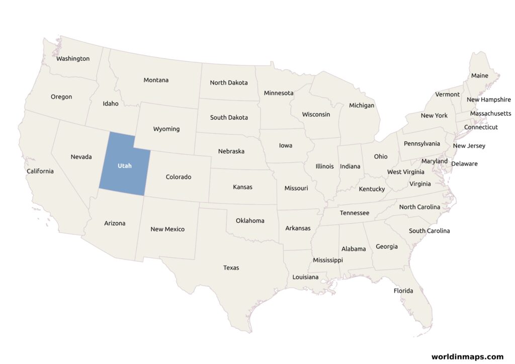
Utah is located in the Western United States region. It is bordered on the north by Idaho and Wyoming, on the east by Colorado, on the southeast by New Mexico, on the south by Arizona and on the west by Nevada.
Map of Utah
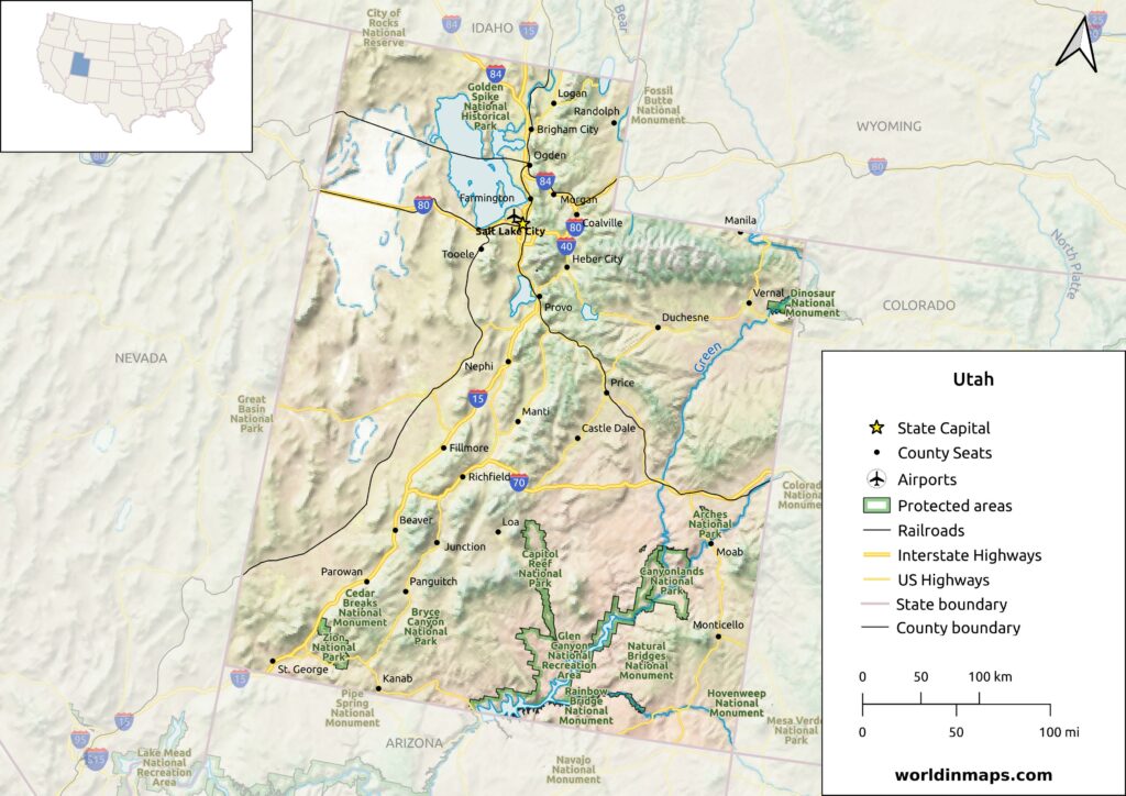
Utah counties map with the county seat cities
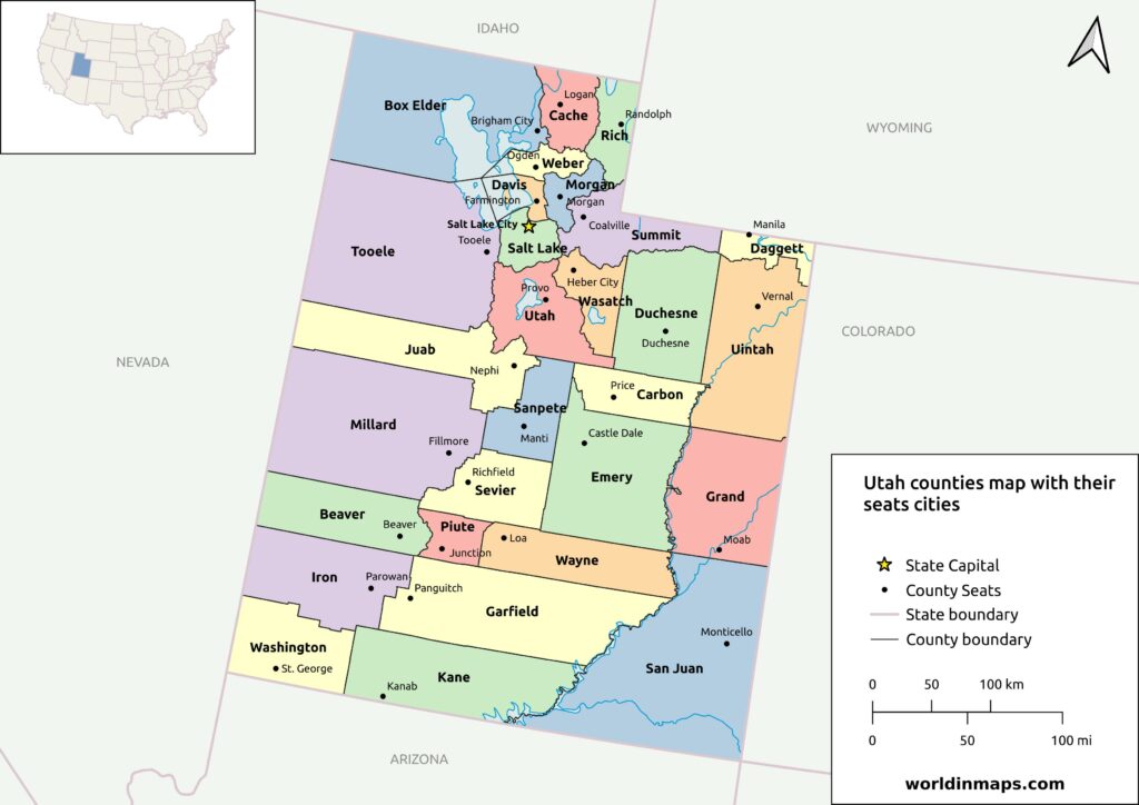
The U.S. state of Utah has 29 counties. The table below lists all of them alphabetically with their County seat, their population and area.
| County | County seat | Population | Area |
|---|---|---|---|
| Beaver County | Beaver | 7,072 | 2,590 sq mi (6,708 km²) |
| Box Elder County | Brigham City | 57,666 | 5,746 sq mi (14,882 km²) |
| Cache County | Logan | 133,154 | 1,165 sq mi (3,017 km²) |
| Carbon County | Price | 20,412 | 1,478 sq mi (3,828 km²) |
| Daggett County | Manila | 935 | 697 sq mi (1,805 km²) |
| Davis County | Farmington | 362,679 | 299 sq mi (774 km²) |
| Duchesne County | Duchesne | 19,596 | 3,241 sq mi (8,394 km²) |
| Emery County | Castle Dale | 9,825 | 4,462 sq mi (11,557 km²) |
| Garfield County | Panguitch | 5,051 | 5,083 sq mi (13,165 km²) |
| Grand County | Moab | 9,669 | 3,672 sq mi (9,510 km²) |
| Iron County | Parowan | 57,289 | 3,297 sq mi (8,539 km²) |
| Juab County | Nephi | 11,786 | 3,392 sq mi (8,785 km²) |
| Kane County | Kanab | 7,667 | 3,990 sq mi (10,334 km²) |
| Millard County | Fillmore | 12,975 | 6,572 sq mi (17,021 km²) |
| Morgan County | Morgan | 12,295 | 609 sq mi (1,577 km²) |
| Piute County | Junction | 1,438 | 758 sq mi (1,963 km²) |
| Rich County | Randolph | 2,510 | 1,029 sq mi (2,665 km²) |
| Salt Lake County | Salt Lake City | 1,185,238 | 742 sq mi (1,922 km²) |
| San Juan County | Monticello | 14,518 | 7,820 sq mi (20,254 km²) |
| Sanpete County | Manti | 28,437 | 1,590 sq mi (4,118 km²) |
| Sevier County | Richfield | 21,522 | 1,911 sq mi (4,949 km²) |
| Summit County | Coalville | 42,357 | 1,872 sq mi (4,848 km²) |
| Tooele County | Tooele | 72,698 | 6,941 sq mi (17,977 km²) |
| Uintah County | Vernal | 35,620 | 4,480 sq mi (11,603 km²) |
| Utah County | Provo | 659,399 | 2,003 sq mi (5,188 km²) |
| Wasatch County | Heber City | 34,788 | 1,176 sq mi (3,046 km²) |
| Washington County | St. George | 180,279 | 2,426 sq mi (6,283 km²) |
| Wayne County | Loa | 2,486 | 2,461 sq mi (6,374 km²) |
| Weber County | Ogden | 262,223 | 576 sq mi (1,492 km²) |
Protected areas
National Parks
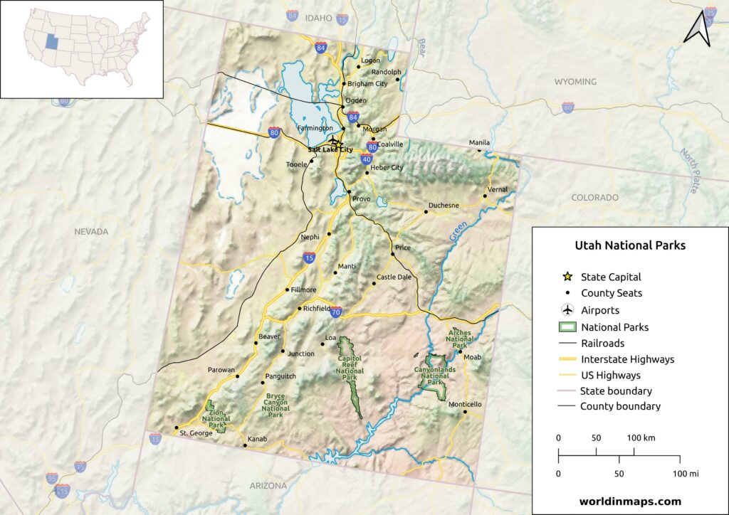
With 5 national parks, Utah has the third most national parks, after Alaska and California. All the National parks in Utah are located on the southern part of Utah, along the Colorado River.
Arches National Park
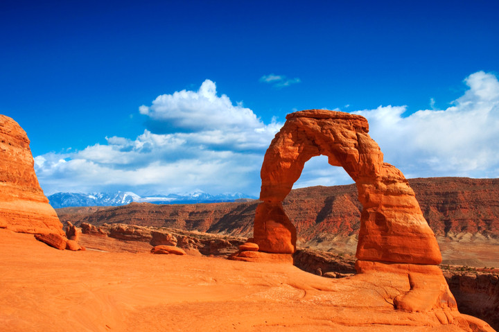
The Arches National Park is located in the southeast of Utah, along the Colorado river and 4 miles (6 km) north of the city of Moab. With more than 2000 natural sandstone arches, it is the highest density of natural arches in the world. The well know Delicate Arch can be admired in this park.
Bryce Canyon National Park
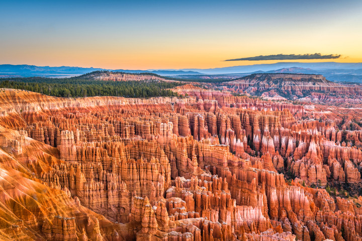
The Bryce Canyon National Park is located in the southwest of Utah. Despite its name, the Bryce Canyon National Park is not a canyon, but a collection of giant natural amphitheatres. The red, orange and white colors gives a spectacular view to the visitors.
Canyonlands National Park
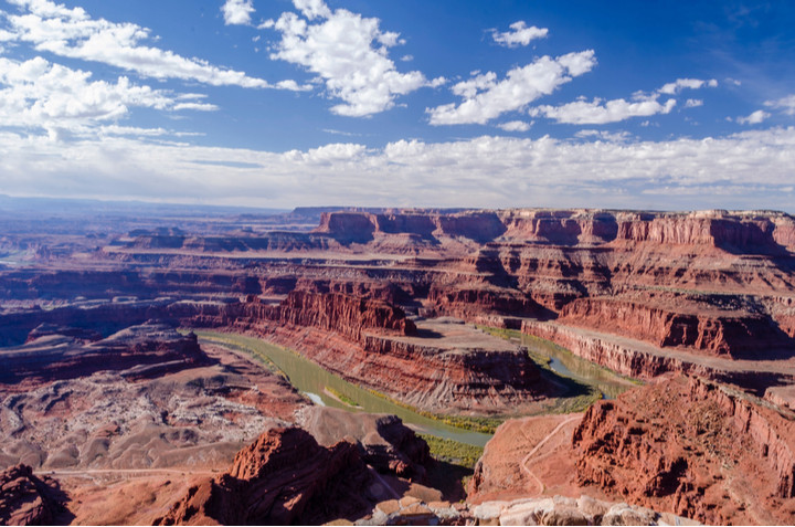
The Canyonlands National Park is in the southeast of Utah near the town Moab. The canyons were formed by the erosion of the Colorado plateau by the Green and the Colorado rivers and their tributaries.
Capitol Reef National Park
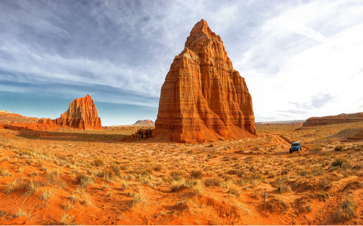
This national park is located in the central south part of Utah. The park was established in 1971 to protect this desert landscape.
Zion National Park
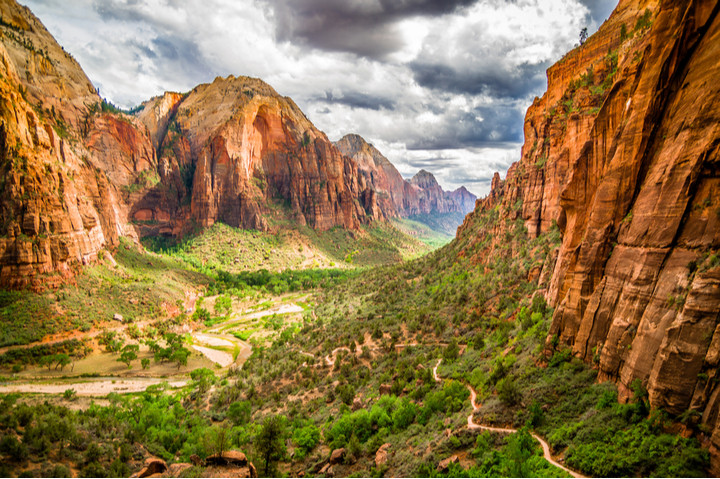
The Zion National Park is located in southwestern Utah. Its most spectacular feature is the Zion Canyon with its 15 miles (24 km) long and up to 2,640 ft (800 m) deep.
National Monuments
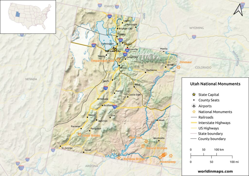
Utah also counts 8 national monuments in its territory.
Bear Ears National Monument
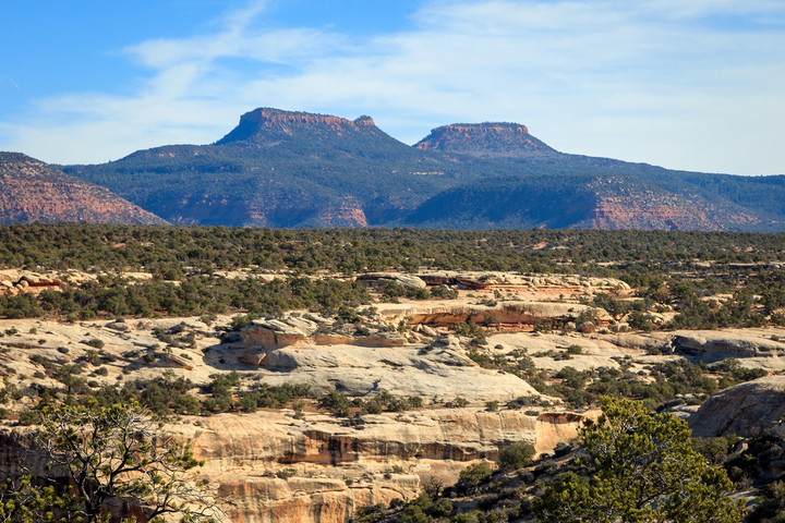
The monument is located in southeastern Utah and it was established in 2016 to protect the land surrounding the Bears Ears and the Indian Creek canyon.
Cedar Breaks National Monument
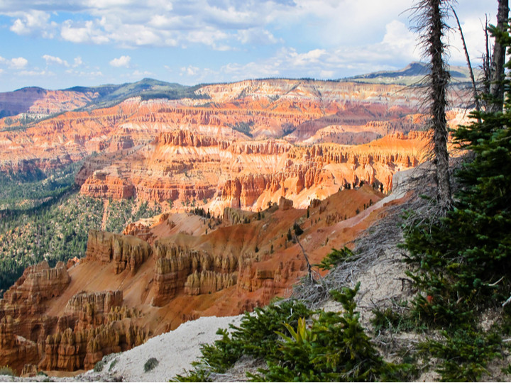
The Cedar Breaks National Monument is located near Cedar City. It is a natural amphitheater of 3 miles (4.8 km) and with a depth of over 2,000 feet (610 m).
Dinosaur National Monument
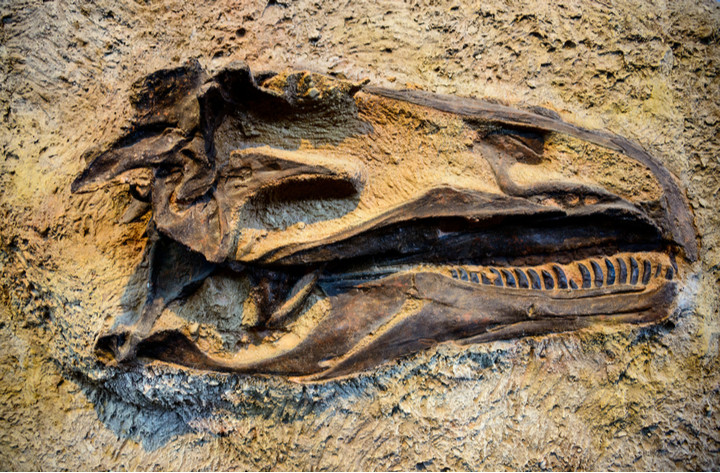
The Dinosaur National Monument is located in the Colorado and Utah. Like say in its name, the Dinosaur National Monument is famous for its Dinosaur Quarry. The park contains over 800 paleontological sites with numerous fossils of dinosaurs.
Grand Staircase-Escalante National Monument
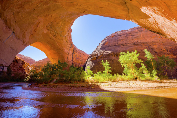
This U.S. national monument is established to protect its spectacular Grand staircase of cliffs and terraces. The monument is composed of different geologic features like monoliths, slot canyons, natural bridges and arches. This place was one of the last parts of the United States to be mapped because of its remote location and rugged landscape.
Hovenweep National Monument
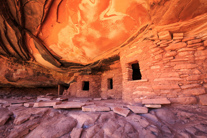
The Hovenweep National Monument is located in southwestern Colorado and southeastern Utah. This monument is famous for its 6 Ancestral Puebloans villages (also known as the Anasazi).
Natural Bridges National Monument
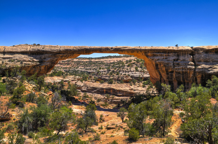
This U.S. national monument is located in southeast Utah and it is well known for its three natural bridges: Kachina, Owachomo and Sipapu.
Rainbow Bridge National Monument
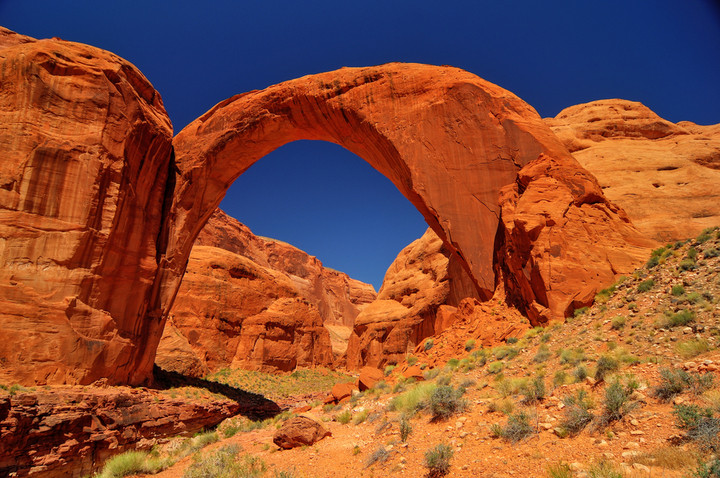
This natural bridge is located in southern Utah and it is often considered as the world’s highest natural bridge with its 234 feet (71 m)
Timpanogos Cave National Monument
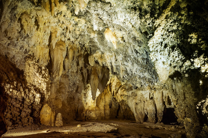
This monument is located in the Wasatch Range. The cave is composed of 3 spectacularly decorated caverns.
National Recreation Areas
2 national recreation areas are located in Utah: Flaming Gorge and Glen Canyon.
The Flaming Gorge is located in Utah but also in Wyoming.
The Glen canyon is located in Utah and also in Arizona. It encompasses the area around the Lake Powell and the lower Cataract Canyon.
National Forests
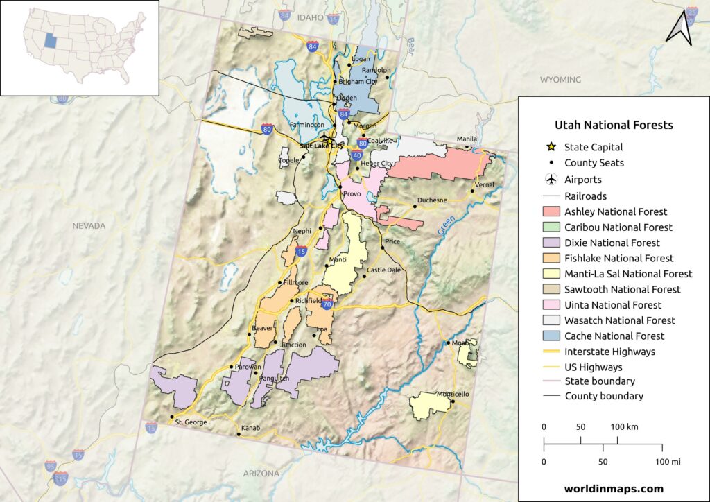
The Utah state also has seven national forests: Ashley, Caribou-Targhee, Dixie, Fishlake, Manti-La Sal, Sawtooth and Uinta-Wasatch-Cache.