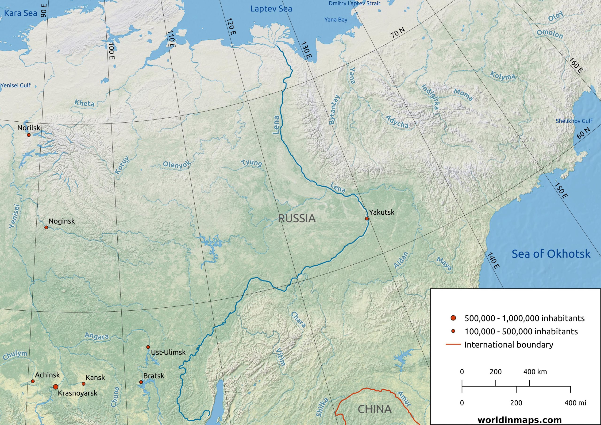
Lena
| Location | |
| Countries | Russia |
| Cities | Yakutsk |
| Physical characteristics | |
| Sources | |
| Location | Baikal Mountains (Irkutsk Oblast) |
| Elevation | 1,640 m (5,380 ft) |
| Mouth – Lena Delta | |
| Location | Arctic Ocean (Laptev Sea) |
| Elevation | 0 m (0 ft) |
| Length | 4,294 km (2,668 mi) |
| Basin size | 2,490,000 km² (960,000 sq mi) |
| Discharge | |
| Average | 16,300 m³/s (575,629 cu ft/s) |
The Lena is a Siberian river in Russia, the easternmost of the three great rivers which drain this immense northern region of Asia along a south-north axis (the other 2 being the Ob and the Yenisey). 4,294 km (2,668 mi) long, it is the longest river in Russia, the eleventh longest in the world.
The drainage basin covers approximately 2,490,000 km² (960,000 sq mi). The forest covers 84% of the basin’s surface: larch dominates, but there are also pines and birches (less than 10%).
The regions crossed by the river are among the least populated lands on the planet: the hostile climatic conditions and the remoteness to densely populated regions make life difficult and severely restrict the number of viable activities. The river basin has a total population of 2.3 million inhabitants
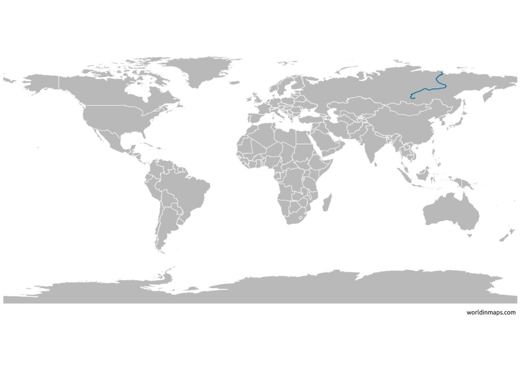
The Lena River map