Weather and Climate | Home / Weather and Climate / Tornadoes around the world
Tornadoes around the world
A tornado (also called a twister) is an extreme meteorological event that can be very dangerous for populations and can cause a lot of damage. According to the World Meteorological Organization, tornadoes kill between 300 and 400 people each year and including 150 only in the United States. Indeed, some regions are more vulnerable and more exposed to tornadoes. But before explaining their distribution around the world, we need to understand how they formed.
Table of contents
- How are tornadoes formed
- What causes a tornado to stop?
- Categories of tornadoes (Enhanced Fujita scale)
- Types of tornadoes
- What looks like a tornado but isn’t?
- Where do tornadoes occur in the world?
- Tornado Alley
- Dixie Alley
- Hoosier Alley
- Carolina Alley
- The 10 most deadliest tornado in the world
How are tornadoes formed
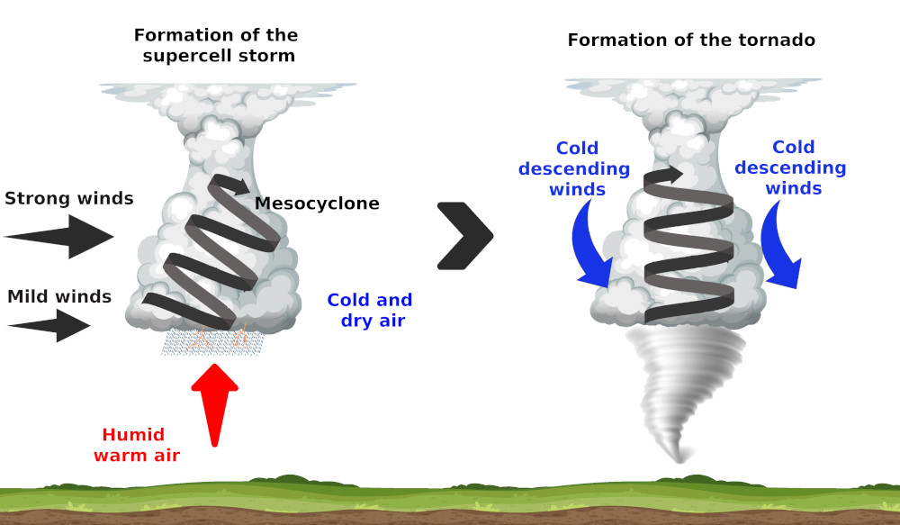
Tornadoes form only under very precise conditions. Most of the tornadoes form in a supercell thunderstorm. These storms are very powerful thunderstorms that form essentially in summer.
Indeed, the sun warms the ground, giving a warm and wet air parcel. This air that escape from the ground is warmer and so less dense. As a result the air parcel will rise.
The air parcel, by rising up, will meet a cold and dry air. The wet air parcel will condense and form a cumulus cloud. If the air above is cold and dry enough and they air that rise warm and wet enough, it will continue to raise until the tropopause to form a cumulonimbus. This cycle is the standard cycle of a thunderstorm, but we still don’t have a supercell.
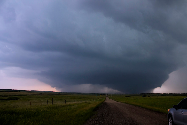
To get a supercell thunderstorm, there needs to be a wind speed variation (more quickly with the altitude) or directions variation with the altitude. This effect is the so called wind shear. This will induce a horizontal rotation inside the cloud. This horizontal tube will be pushed to the vertical by the ascending air of the cumulonimbus. This gives finally an inclined rotating tube of air inside the cumulonimbus, which is called a mesocyclone. By then the full cloud starts to rotate, which by now can be called a supercell thunderstorm.
These supercell thunderstorms can stay active for hours with heavy rain, hailstone and thunders.
To get a tornado from these supercell thunderstorms, we need more powerful winds. Inside the cloud, the rain cools the air, which become more dense and they go down to the ground. These downward currents encircle the mesocyclone and force him to the vertical. A small cone, called tuba, form under the cumulonimbus. The winds accelerate until the ground surface and when the tuba touch the ground, we get a tornado with winds that can flow with a speed of 400km/h (250 mph).
Not every supercell thunderstorms produce tornadoes. Only around 20 percent of all supercell thunderstorms produce tornadoes.
What causes a tornado to stop?
The phenomenon is fading when the balance between rising and falling air is no longer maintained or when the tornado meets a relief.
Categories of tornadoes (Enhanced Fujita scale)
Tornadoes are categorized by order of their seriousness of the damage that they cause. The first scale used for this classification was the Fujita scale, also called the Fujita-Pearson Scale or F scale. This scale was established in 1971 by Ted Fujita and Allen Pearson.
It is important to note that this classification is not based directly on the wind speed, but rather on the damage caused by the tornado. The categories of tornadoes are determined afterwards the tornadoes is done.
The Fujita had originally 6 categories (from F0 to F5) which is add 7 theoretical categories never met en that go from F6 to F12.
Average wind speed in the tornado, 10 m altitude above flat ground, are given for indication (harder short time winds are possible). These wind speeds are indicative because no direct relation between wind speeds and damages have been done.
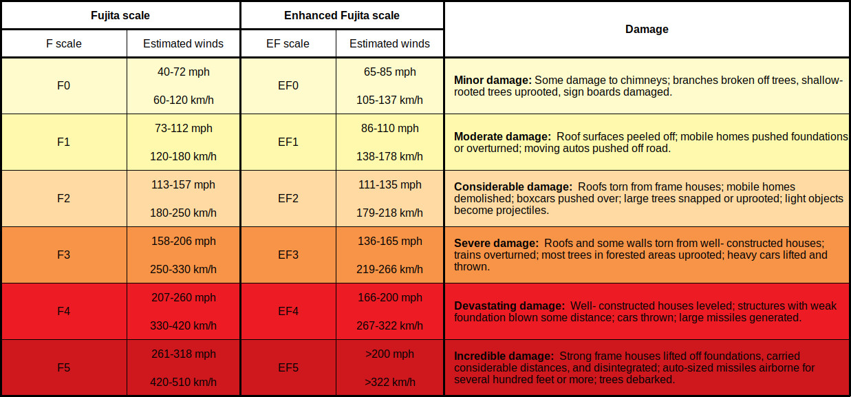
The Fujita scale had received some critics because it didn’t take into account some factors like the quality of the materials of the buildings, not enough indicators,… Because of this, an Enhanced Fujita scale has been released in 2007. This new scale has 28 indicators, which helps to take into account much more types of building and quality of buildings. It also uses an estimation of speeds obtained by meteorological radars. This new scale also helps to categorize tornado in every part of the world more accurately.
The 2 scales are similar and have the same categories. Only the way to determine the intensity of the damage is different and also the speeds of the winds to produce these damages are different. Indeed, the meteorologist had the impression that the winds in the first scale were too high for the damage caused. Indeed, the total devastation of the F5 was caused following the scale by winds of 420 km/h (261 mph) and the new scale determine the speed necessary to be 322 km/h (200 mph).
Types of tornadoes
Tornadoes are usually distinguished in supercell and non-supercell, with therein different subtypes.
Supercell tornadoes
These tornadoes are the most common and often the most dangerous. In function of their shape and size, we can distinguish different subtypes. Tornadoes that lived for a certain time may transit from one type to another as it changes in size and shape during its life.
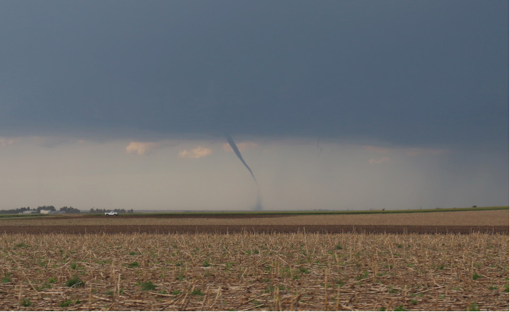
Rope tornado
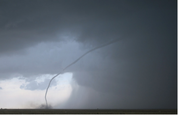
They have the shape of a rope and they are the most common types and the smallest tornadoes. Most tornadoes begin and end their life as a rope tornado. Some also stay in this type and only last a few minutes.
Although they are the smallest of all the tornado, they are still dangerous and some of them get more intense as they narrow and tighten.
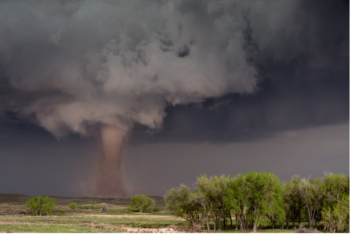
Cone tornado
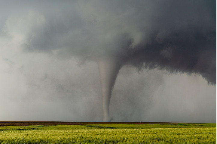
This type of tornado has the “typical” conical shape of a tornado with a wider base than the robe tornadoes and they are much wider on the side touching the thunderstorm.
The cone tornadoes have a wider footprint on the ground and so they can leave a larger trail of destruction.
Stovepipe or cylinder tornado
Theses tornadoes are similar to the cone tornado, but the width on the ground is similar the width at the base of the thunderstorm.
Wedge tornado
Wedge tornadoes are wider than they are tall (at least as wide as their height cloud-ground). The width is around 1 km (0.6 mile) and more. Wedge tornadoes are usually classified EF-3 or more. These tornadoes leave huge destruction trails.
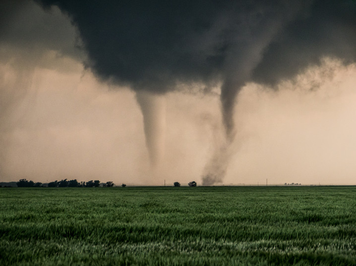
Satellite tornado
A satellite tornado is a tornado located around a main primary tornado and is interacting with the same mesocyclone. Satellite tornadoes are apart from the primary tornado and so they are different then multiple vortex tornadoes. These types of tornadoes are not common. The satellite tornado and the primary tornado are called a couplets.
Multiple vortex tornado
A multiple vortex tornado is a tornado with several vortices (called subvortices or suction vortices) circling around or inside and as a part of the main vortex. The subvortex can produce localized area of higher winds than the main circulation.
This type of tornado is difficult to observe because of the dirt and debris carried upward. They are visible when the tornado form or when the condensation and the debris are balanced. They form usually in the lower part of the tornado vortex where the tornado makes contact with the surface.
Non-supercell tornadoes
Non-supercell tornadoes are not linked with a storm rotation and are rather created by a vertically spinning parcel of air occurring near the ground. These tornadoes cause less damages than the supercell tornadoes.
Landspout
Landspout is a narrow rope-like condensation funnel that form while the thunderstorm cloud is still growing. They are formed by a vertically spinning parcel of air occurring near the ground. These tornadoes are weaker than the one caused by supercell, but they can still cause serious damage (until EF2).
Waterspout
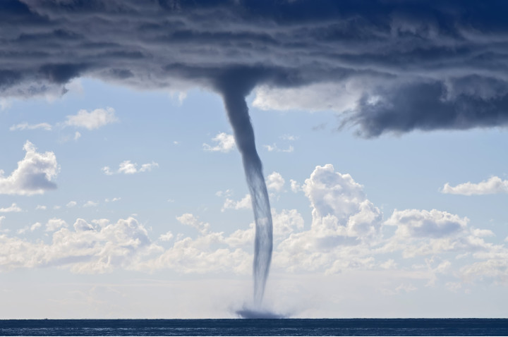
Waterspout are like landspout, but they form above water. A few of the waterspout are stronger and can be caused by a supercell thunderstorm. But the big majorities are non-supercell tornadoes. Sometimes they can hit the ground and then become a land tornadoes.
What looks like a tornado but isn’t?
Some phenomenon looks like tornadoes because they have the same rotation characteristics, but they are not considered like tornadoes. Indeed a tornado needs to be linked with a storm event. Below is a list of events that looks like tornadoes, but that are not.
Gustnado
Gustnado (or gust front tornado) are small vertical swirl associate with a gust front of a storm system. They look like real tornadoes, but they are not connected to the base of the cloud and so they are not considered as tornadoes.
Dust devil
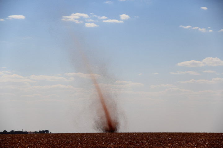
Dust devil are also composed of a vertical swirling column of dust, which make them look like a tornado, but it is not a tornado because there is no link with a cloud. They form under clear skies and hot day. They are formed by a strong convective updraft from the warm air on the ground surface and low level wind shear.
They have diameters from 1 centimeter to 10 meters and a vertical extension that goes from a few meters to more than 1000 meters.
They last only for a few minutes and they can be as strong as the weakest tornadoes. So they can cause minor damages.
Dust devil is the common name, but it has local names like willy-willies in Australia
Fire whirls
Fire whirls are not common and usually very weak, but it can be as strong as an EF3. They are associated with wildfires and the large difference of temperature between the fire on the ground and the cooler air in altitude causes the air to rise. The rising air and the wind circulation above the ground create the rotation.
Steam devils
Steam devils are very rare to observe. They are rotating updraft of steam or smoke. They are not linked with high wind speeds (the rotation is at a speed of only a few rotations per minutes). They form mostly from smoke from power plants, but it can also form above hot springs, deserts, water areas, …
Where do tornadoes occur in the world?
Tornadoes occur in different regions of the world, but some of them are more hits.
The United States are hit by the highest number of tornadoes and they are of very high intensity. Between 800 and 1300 tornadoes are registered in the US each year and around 20 of them are from the EF4 or EF5 category.
| Rank | States | Annual average number of tornadoes by 10,000 sq miles (25 900 km²) |
|---|---|---|
| 1 | Florida | 12.2 |
| 2 | Kansas | 11.7 |
| 3 | Maryland | 9.9 |
| 4 | South Caroline | 9.8 |
| 5 | Illinois | 9.7 |
| 6 | Mississippi | 9.2 |
| 7 | Iowa | 9.1 |
| 8 | Oklahoma | 9 |
| 9 | Alabama | 8.6 |
| 10 | Lousiana | 8.5 |
| 11 | Arkansas | 7.5 |
| 12 | Nebraska | 7.4 |
| 13 | Missouri | 6.5 |
| 14 | North Caroline | 6.4 |
| 15 | Tennessee | 6.2 |
| 16 | Texas | 5.9 |
| 17 | Minnesota | 5.7 |
The highest density of tornadoes in the world is located in Florida and they are mostly of low intensity in this region.
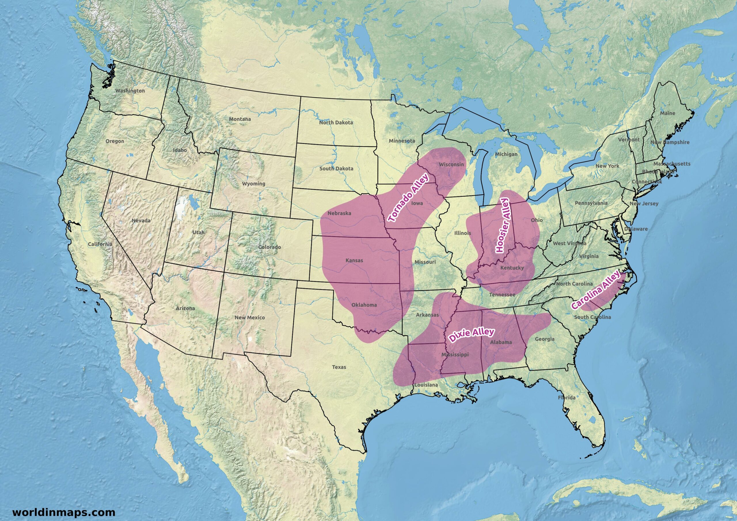
But the most active area is the Basin of the Mississippi River and the Great Plains in the United States. The tornadoes are there generally very powerful. It is for this reason that the states of Texas, Oklahoma, Kansas, Nebraska, Arkansas, Missouri, Iowa and Wisconsin were given the name Tornado Alley witch one third of the Tornadoes of the United States. The next chapters will detail the four main United States Alleys (Tornado Alley, Dixie Alley, Hosier Alley and the Caroline Alley).
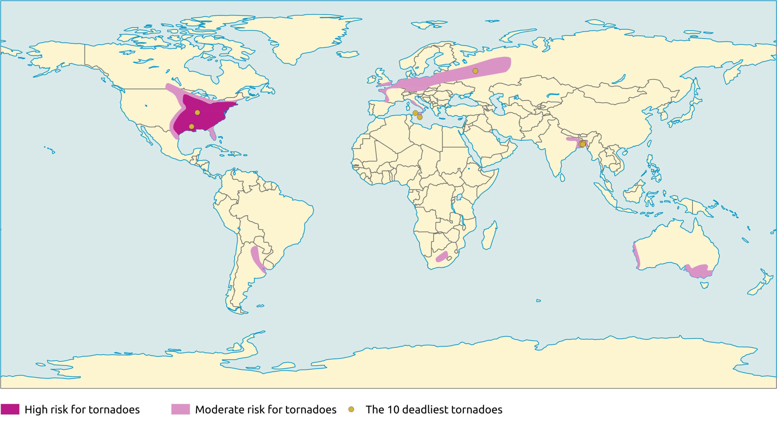
Other parts of the world are also hit by tornadoes. In Africa, they can be found in South Africa.
In South America they happen in some regions of Argentina, Paraguay and the south part of Brazil.
In Europe, they are more common in the plain of northern Europe, especially in Germany and Poland. But in terms of density it is in the Netherlands that they are the highest with 20 tornadoes per year and a density of 0,00048 per square kilometer. Then it is followed by the United Kingdom and its 33 tornadoes. Mostly they are from very low intensity and they are mostly EF1. The European Tornado Alley is located between the Benelux (Belgium, Netherlands and Luxembourg) and Germany.
Tornadoes also happen in Australia and New Zealand.
Finally, they are also very common in the Delta of the Gange in Bangladesh. They are as often and strong as in the United States and count more dead each year than in the United States. But there is less mediatization about them.
Urban and rural areas are both touched by tornadoes. Some big cities report numerous tornadoes in their metropolitan area like Miami, Oklahoma City, Dallas, Dhaka, …
The reporting number of tornadoes is strongly depending on the distribution of the world population. For example, Canada report 80 to 100 tornadoes each year, but big areas of Canada are sparsely populated and the real number is probably much higher.
Tornado Alley
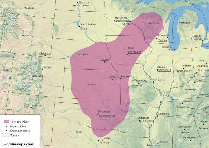
The Tornado Alley refers to a central region of the United States, covering several states or parts of states, where tornadoes are frequent.
There is not exact delimitation of the Tornado Alley, and the boundaries depends on the statistics used.
The Tornado Alley totally include the Oklahoma, the Kansas and the Iowa states. It covers also the northeast of the Texas, the northwest of the Arkansas, the west of the Missouri, the east of the Nebraska, a little part of the south of the South Dakota, the southeast of the Minnesota, a little part on the northwest of the Illinois and finally the central part and the southwest of the Wisconsin.
Although tornadoes occur in every region of the United States, they are much more frequent in this region located in the great plain, between the Rocky Mountains and the Appalaches where the condition for tornadoes are optimal.
Indeed, the Tornado Alley is located at the meeting of the continental cold air parcels coming from the Canadian Prairies, with the dry and hot air from the desert of Sonora, the hot and wet air coming from the Gulf of Mexico and finally with high variation of winds with altitude because of the presence of a Jet Stream.
Tornadoes can occur all the year around, but their frequency varies during the tornado season. Indeed the Tornado Alley trend to switch to the north with the warming of the temperature, from spring to summer, and on the opposite to the south when the temperature become colder in autumn.
The consequence of this Tornado Alley is that in its center part the building standards are more strict. With for example reinforced roof, tornado shelters, …
Dixie Alley
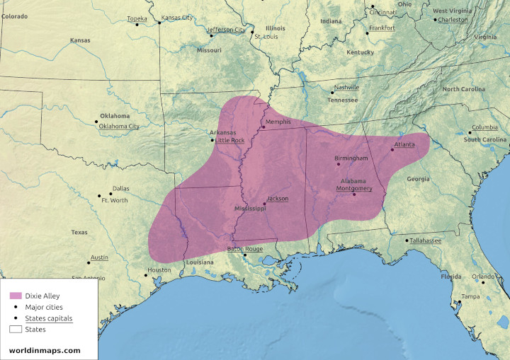
The Dixie Alley is the name given to a region of the United States where a very high number of tornadoes happen each year and of very high intensities.
The Dixie Alley includes much of the region of the lower Mississippi. It includes the following states: Mississippi, Louisiana, the east of Texas, the east of Arkansas, the southwest of Tennessee, the Alabama and the north of Georgia.
This region is under favorable condition to produce tornadoes, which explain their high numbers. Indeed, it has the same condition as the Tornado Alley. The region is under the cold continental air coming from the north and the hot and wet air from the Gulf of Mexico. This creates a very unstable condition. The cold air flowing to the southeast uplift the hot air. These hot air parcels continue their uplift and the humidity condense to create storms with very height vertical extension, the so called cumulonimbus clouds.
From autumn to spring, the region is under winds that are from different directions and intensity with the altitude, because of the presence of a Jet Stream. This wind shear will create the supercell thunderstorms that will be able to give tornadoes. In the summer the Jet Stream moves to the north.
The pic of intensity of tornadoes in this region is around May and with a second wave in October and November. But tornadoes can be seen all the year around. Which make them very dangerous in this region because a tornado can still happen outside the tornado season, when people’s vigilance is lower.
Indeed, this region produces less tornadoes then the Tornado Alley, but there is more dead in this region each year than in the Tornado Alley. Another reason is that tornadoes are very powerful in this region and that they travel long distances in an area of high population density. According to the National Centers for Environmental Information, Texas, Alabama, Mississippi, Arkansas and Tennessee are States on top of the ranking of the number of deaths from tornadoes between 1950 and 2006. Another factor is that the supercell thunderstorms also happen during the night, which can surprise people in their sleep. Finally the storms produce very high precipitation, which make the tornado difficult to see.
Hoosier Alley
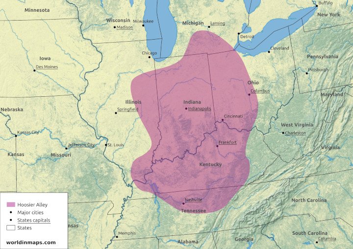
The Hoosier Alley is the third most active area in the United States for tornadoes. This alley is centered on the Indiana and includes the east of Illinois, the Kentucky, the north of Tennessee and the west of Ohio. Like for the Dixie Alley these storms are fast moving and with a lot of rain, which make the tornadoes difficult to see.
Carolina Alley
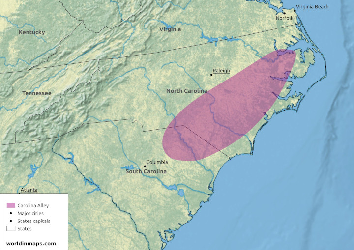
The Carolina Alley is the fourth most active area for tornadoes in the Unites states. This alley is located in North Carolina and the northeastern of South Carolina.This alley is also concerned with fast moving storm and heavy rains.
The 10 deadliest tornado in the world
| Rank | Name / location | Country | Date | Deaths |
|---|---|---|---|---|
| 1 | Daultipur and Saturia | Bangladesh | 26 April 1989 | 1300 |
| 2 | Tri-State Tornado | US | 18 March 1925 | 695 |
| 3 | Manikganj, Singair and Nawabganj | Bangladesh | 17 April 1973 | 681 |
| 4 | 1969 East Pakistan Tornado | Bangladesh | 14 April 1969 | 660 |
| 5 | Grand Harbour at Valletta | Malta | 23 September 1551 | 600 |
| 6 | Magura and Narail Districts | Bangladesh | 11 April 1964 | 500 |
| 6 | Sicily | Italy | 8 December 1851 | 500 |
| 6 | Madaripur and Shibchar | Bangladesh | 1 April 1977 | 500 |
| 9 | Belyanitsky, Ivanovo, and Balino | USSR | 9 June 1984 | 400 |
| 10 | Natchez, MS | US | 6 May 1840 | 317 |