The Niger river
| Location | |
| Countries | Benin Guinea Mali Niger Nigeria Sierra Leone |
| Cities | Bamako Lokoja Niamey Onitsha Timbuktu |
| Physical characteristics | |
| Sources | |
| Location | Loma Mountains (Sierra Leone) |
| Elevation | 490 m (1,608 ft) |
| Mouth – Atlantic Ocean | |
| Location | Gulf of Guinea (Nigeria) |
| Elevation | 0 m (0 ft) |
| Length | 4,184 km (2,600 mi) |
| Basin size | 2,262,000 km² (873,363 sq mi) |
| Discharge | |
| Niger Delta | |
| Average | 5,589 m³/s (197,400 cu ft/s) |
| Minimum | 500 m³/s (18,000 cu ft/s) |
| Maximum | 27,600 m³/s (970,000 cu ft/s) |
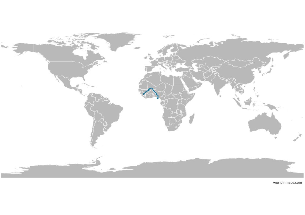
The niger River (le fleuve Niger in French and Djoliba in Mandingo) is a Major river of West Africa. The river is 4,184 km (2,600 mi) in length and it is the third-longest river in Africa, after the Nile and the Congo River.
It takes its source between Sierra Leone and Guinea at an altitude of around 800 m in the Loma Mountains to, after a large loop on the borders of the Sahara, flow into the Atlantic Ocean, in Nigeria. Its course crosses the borders of six states (Sierra Leone, Guinea, Mali, Niger, Benin and Nigeria), two of which take their names directly from the river (Niger and Nigeria).
The Niger River map
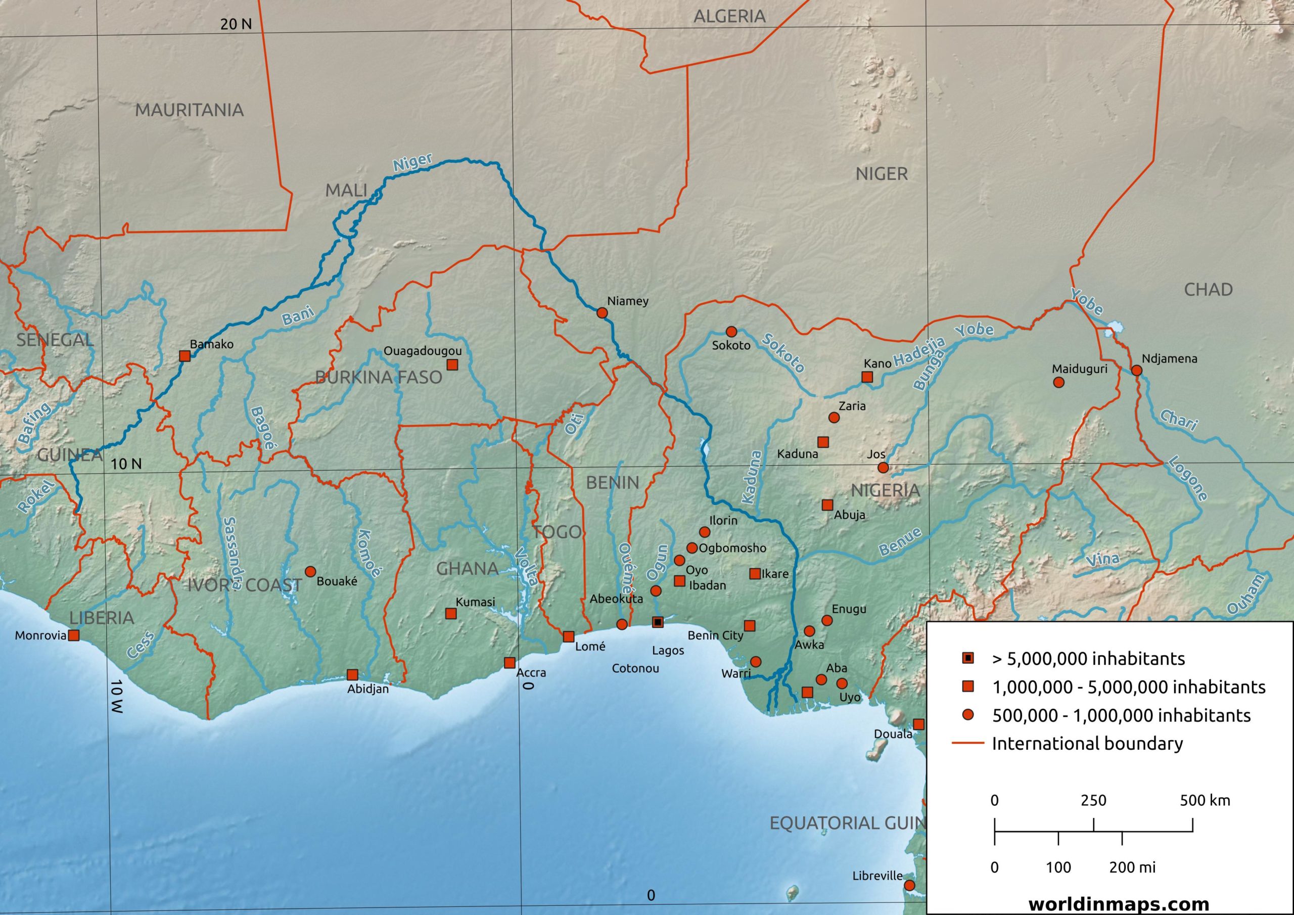
The Niger Delta
The Niger Delta is a very densely populated region with around 31 million people. It is sometimes called the Oil Rivers because it was before a major region of palm oil production. Today the Delta is known to be a petroleum rich region.