Home / countries / Luxembourg / Geography
Geography of Luxembourg
Where is Luxembourg located on the world map?
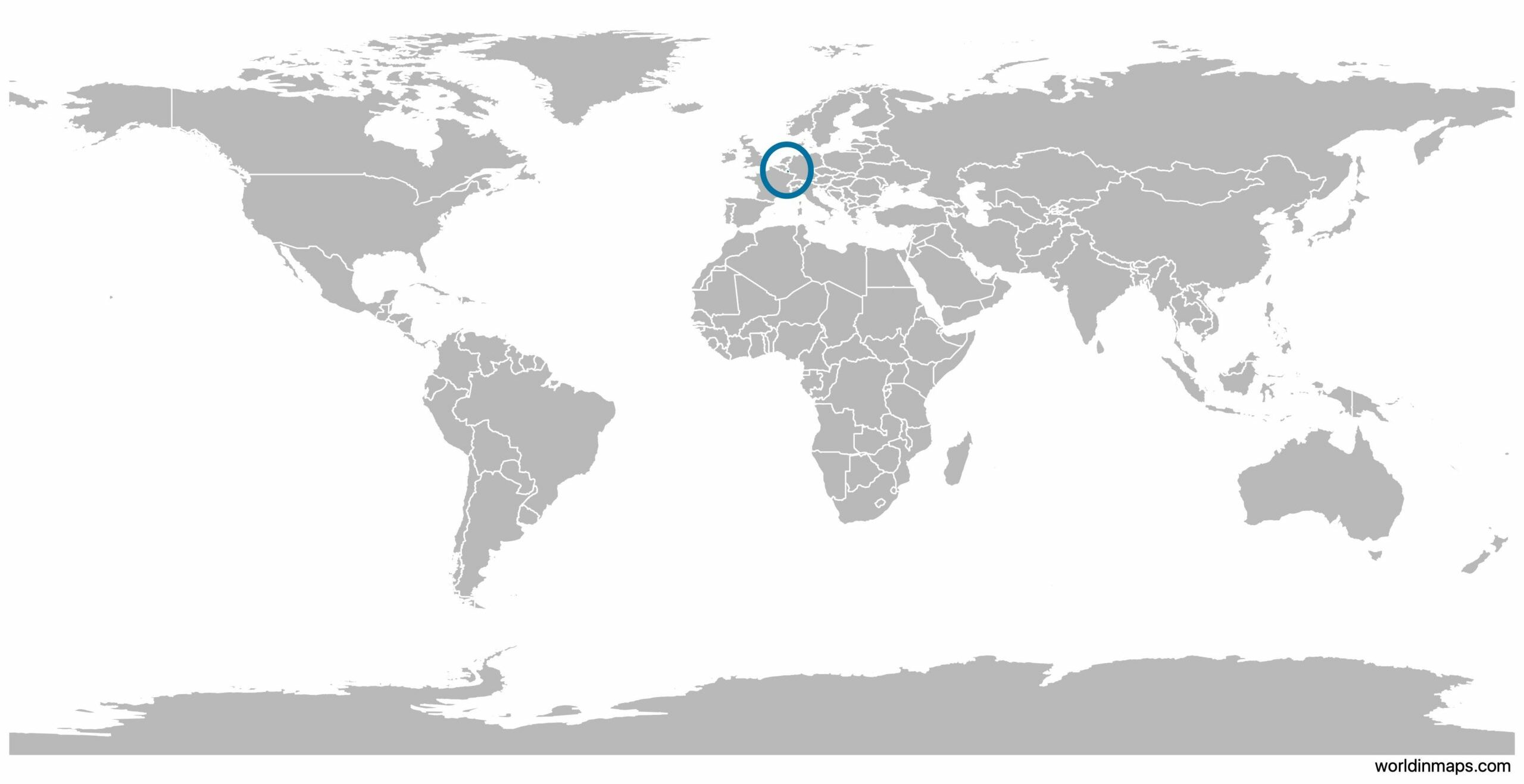
Luxembourg is a little landlocked monarchy in Western Europe. The official name of the Luxembourg is the Grand Duchy of Luxembourg.
With an area of 2586 km² and 634 730 inhabitants (in 2021), it is one of the littlest sovereign nation of Europe.
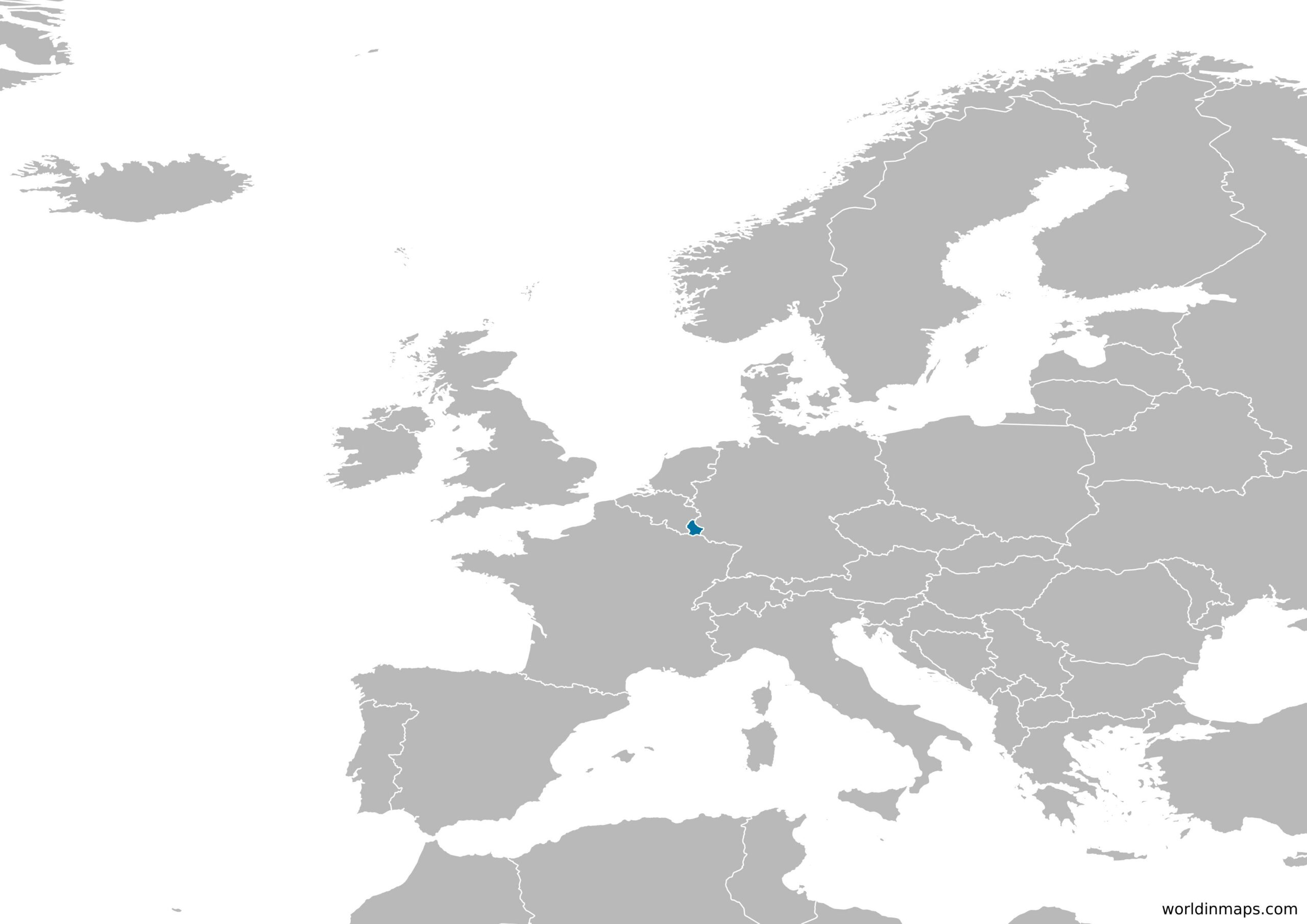
Bordering countries
Luxembourg has 3 bordering countries. The country has common border with Belgium to the west and to the north, Germany to the east and France to the south.
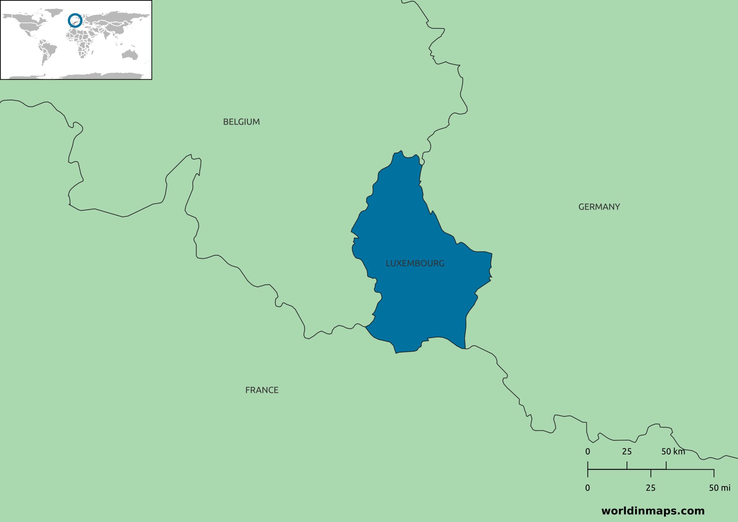
Map of Luxembourg
Geographical features
| Land area | 2 586 km² |
| Water area | 0 km² |
| Total area | 2586 km² (179th) |
| Mean elevation | 325 m |
| Lowest point | |
| Moselle River | 133 m |
| Highest point | |
| The Kneiff in Wilwerdange | 560 m |
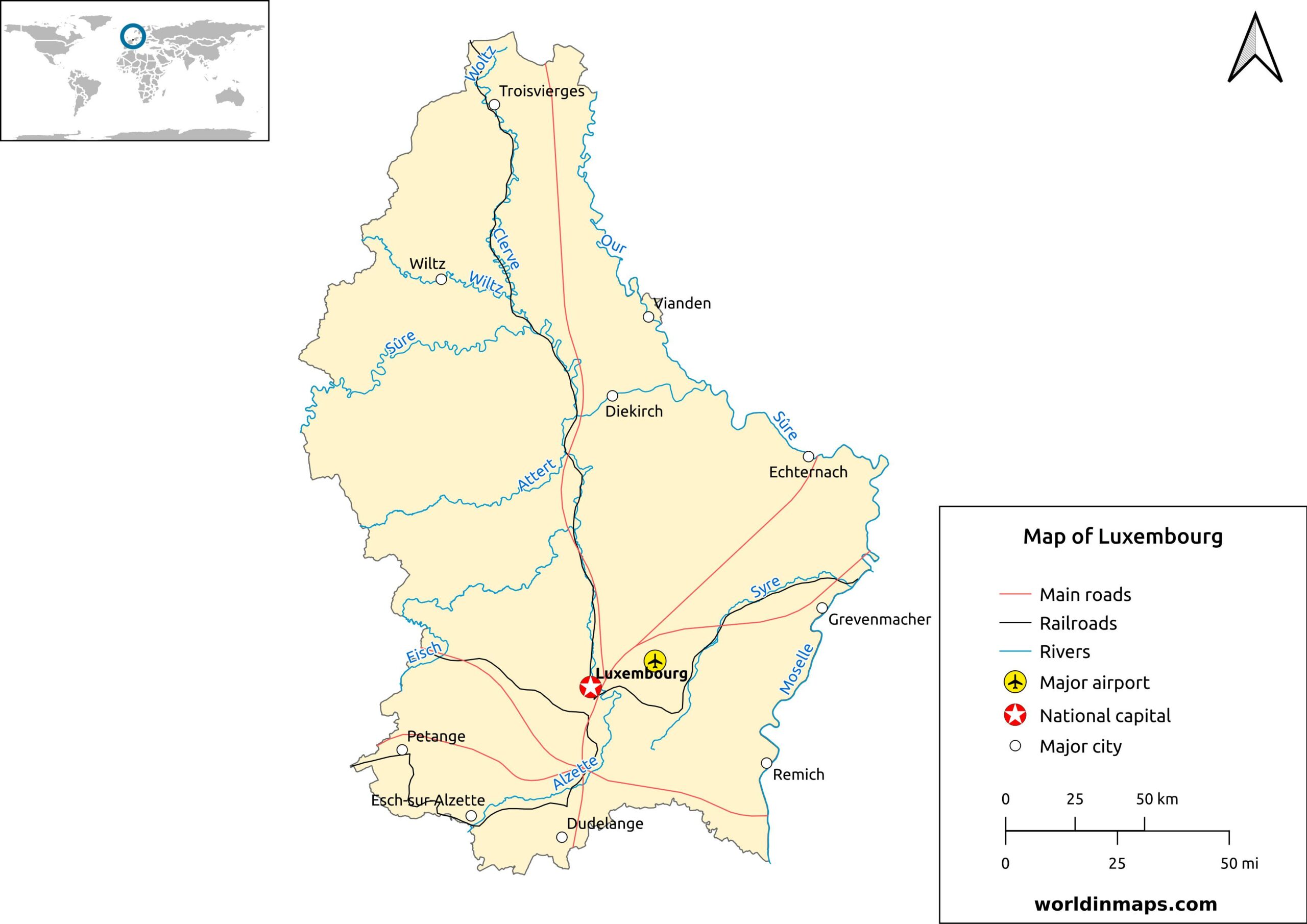
Luxembourg is one of the smallest countries in the Europe and rank 179th in the world by its size. The country is 82 km (51 mi) long and 57 km (35 mi) wide. The geography of the Luxembourg is characterized by 2 natural regions: the Oesling (Éislek in Luxembourgish) in the north and the Gutland in then center and the south of the country.
The Oesling is the Luxembourgish part of the Ardenne (that also cover France, Belgium and Germany). This region is dominated by hills and low mountains. It is in this region that the Kneiff, which is the highest point of Luxembourg, is located.
The Gutland counts for around 68% of the territory of the Luxembourg. This region is more densely populated and it can be divided into 5 geographic sub-regions. It is in this region that the Moselle valley is located, which is the lowest point of Luxembourg.
Land use
The Land use in Luxembourg for 2011 was the following:
| Arable land | 24% |
| Permanent crops | 0.6% |
| Permanent pasture | 26.1% |
| Agricultural land | 50.7% |
| Forest | 33.5% |
| Other | 15.8% |
Luxembourg has a high proportion of forest with 33.5% of the land use. Some regions of the Luxembourg have very thick forest, like in the geographical sub-region of the Little Switzerland.
A big part of the land is also dedicated to the agriculture. It employs only about 1.1 % of the workforce, but it is heavy mechanized. Most farms are active in the dairy and meat production. Luxembourg have also a big production of Vineyards through the Moselle Valley. Annually they produce about 15 million litres of white wine. These are consumed within Luxembourg, Germany, France and Belgium.
Urbanization
The urban population of Luxembourg was 91.5% of the population in 2020. The annual rate of change of the urbanization between 2015 and 2020 was 1.55%.
Administrative divisions

The Luxembourg is divided geographically into 12 cantons, but they don’t have the administrative goal they had in the past. These 12 cantons are subdivided into 102 municipalities.

These 12 cantons were until 2015 also grouped into 3 districts: Diekirch, Grevenmacher and Luxembourg. These were deleted and their competences were taken over by the Ministry of Interior.
| Canton | Capital | Area | Population (2021) | Density | Number of municipalities |
|---|---|---|---|---|---|
| Capellen | Capellen | 199.21 km² (76.92 sq mi) | 50 733 | 255 inhabitants/km² (660 inhabitants/sq mi) | 9 |
| Clervaux | Clervaux | 342.17 km² (132.11 sq mi) | 19 382 | 57 inhabitants/km² (147 inhabitants/sq mi) | 5 |
| Diekirch | Diekirch | 204.51 km² (78.96 sq mi) | 33 944 | 166 inhabitants/km² (430 inhabitants/sq mi) | 10 |
| Echternach | Echternach | 185.54 km² (71.64 sq mi) | 19 463 | 105 inhabitants/km² (272 inhabitants/sq mi) | 7 |
| Esch-sur-Alzette | Esch-sur-Alzette | 242.77 km² (93.73 sq mi) | 185 184 | 763 inhabitants/km² (1976 inhabitants/sq mi) | 14 |
| Grevenmacher | Grevenmacher | 211.37 km² (81.61 sq mi) | 31 378 | 148 inhabitants/km² (384 inhabitants/sq mi) | 8 |
| Luxembourg | Luxembourg | 238.46 km² (92.07 sq mi) | 193 509 | 811 inhabitants/km² (2102 inhabitants/sq mi) | 11 |
| Mersch | Mersch | 223.90 km² (86.45 sq mi) | 34 063 | 152 inhabitants/km² (394 inhabitants/sq mi) | 10 |
| Redange | Redange-sur-Attert | 267.49 km² (103.28 sq mi) | 19 866 | 74 inhabitants/km² (192 inhabitants/sq mi) | 10 |
| Remich | Remich | 127.87 km² (49.37 sq mi) | 23 529 | 184 inhabitants/km² (477 inhabitants/sq mi) | 8 |
| Vianden | Vianden | 78.52 km² (30.32 sq mi) | 5 482 | 101 inhabitants /km² (181 inhabitants/sq mi) | 3 |
| Wiltz | Wiltz | 264.55 km² (102.14 sq mi) | 18 197 | 69 inhabitants/km² (178 inhabitants/sq mi) | 7 |
Major rivers
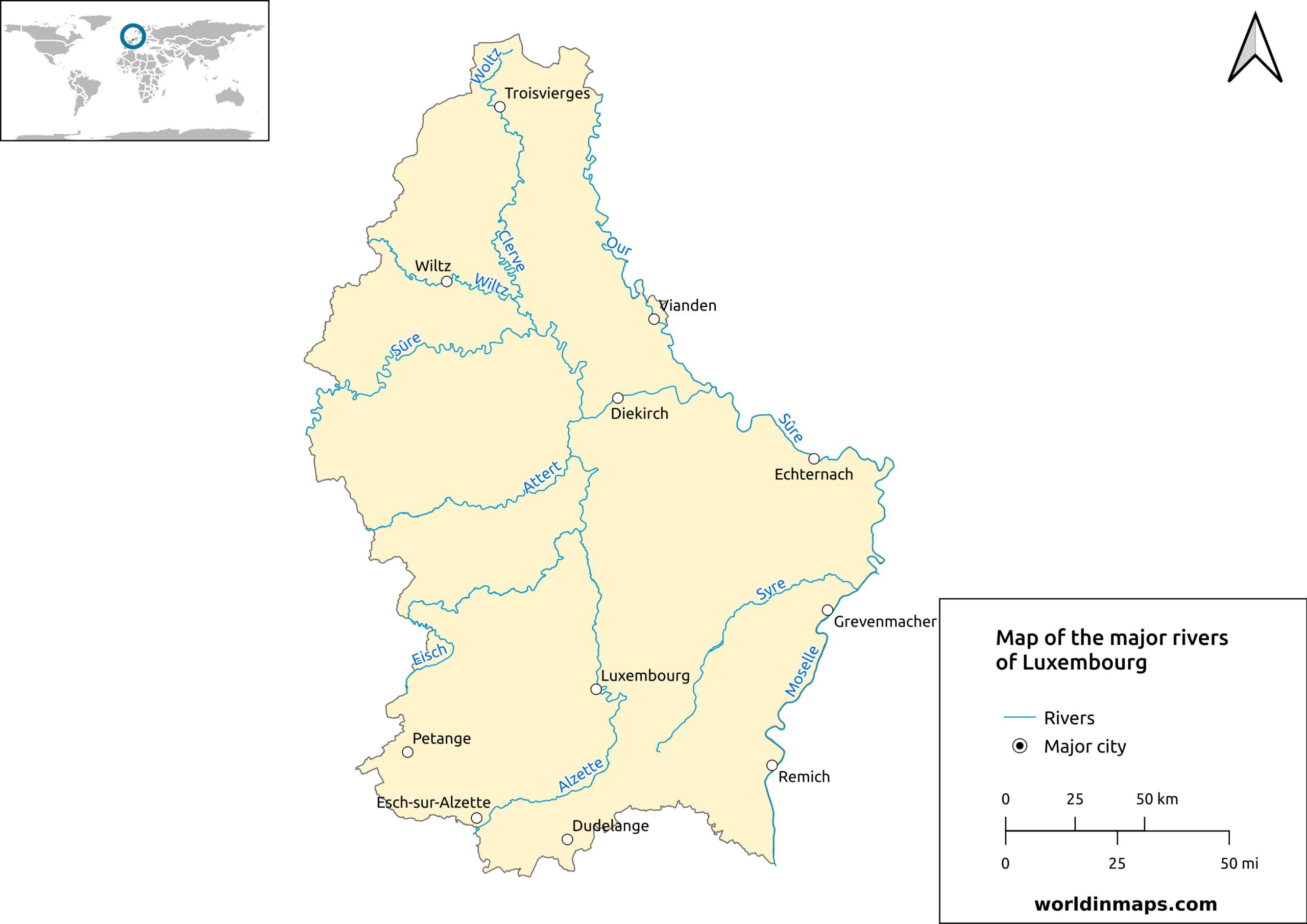
The country of Luxembourg is nearly totally include in the drainage basin of the Moselle, which is a tributary of the Rhine River. Only 2 little rivers (the Chiers and the Foochtbaach) are tributaries of the Meuse River.
The 4 biggest rivers of the Grand Duchy of Luxembourg are the Moselle, the Sûre (or Sauer in Luxembourgish), the Our and the Alzette.