Regions / Central Asia
Location on the world map
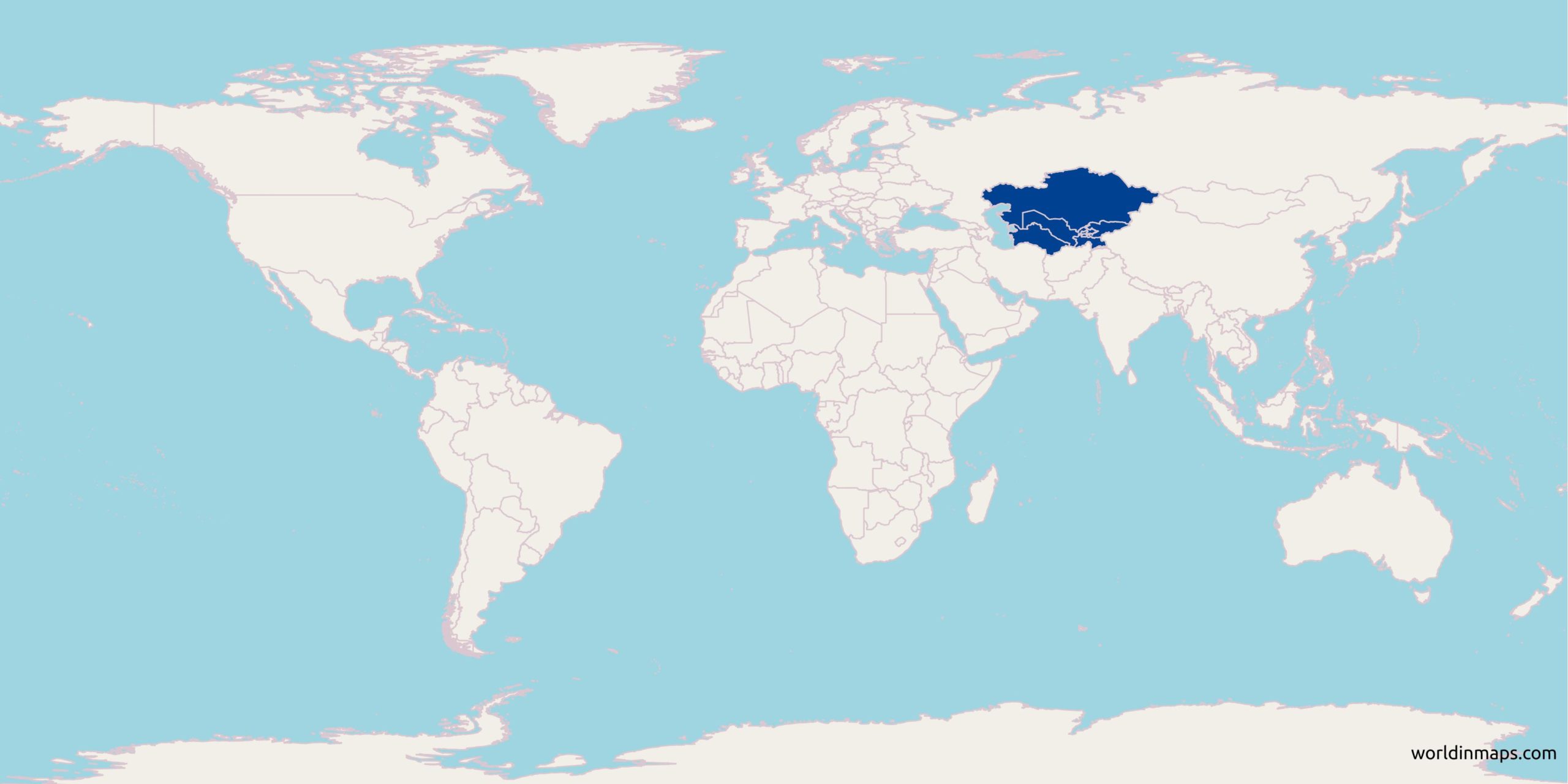
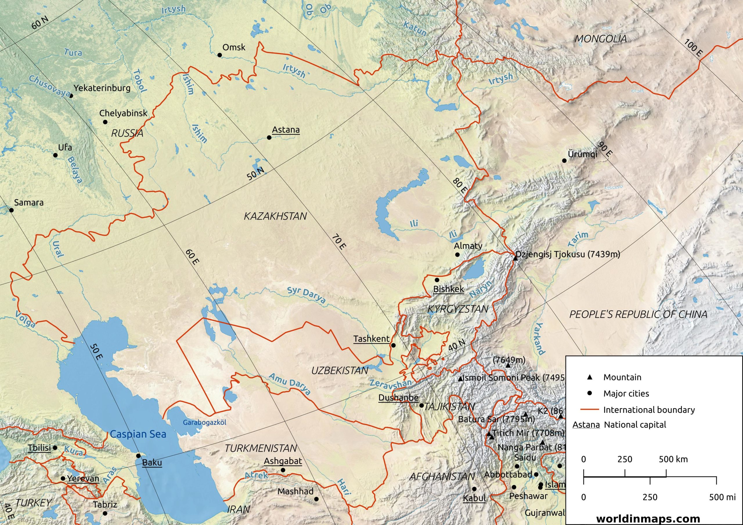
The region of Central Asia is located between the Caspian Sea to the west , China and Mongolia to the east, Afghanistan and Iran to the south and Russia to the north. The region consists of the former Soviet republics of Kazakhstan, Kyrgyzstan, Tajikistan, Turkmenistan and Uzbekistan. They are also sometimes named “the stans” because of their ending with the Persian suffix (stan – meaning land of).
Population
| Population | |
| Population | 72,960,000 (2019) |
| Density of population | 17.4/km2 (45.1/sq mi) |
| Geography | |
| Area | 4,003,451 km2 (1,545,741 sq mi) |
Map of Central Asia
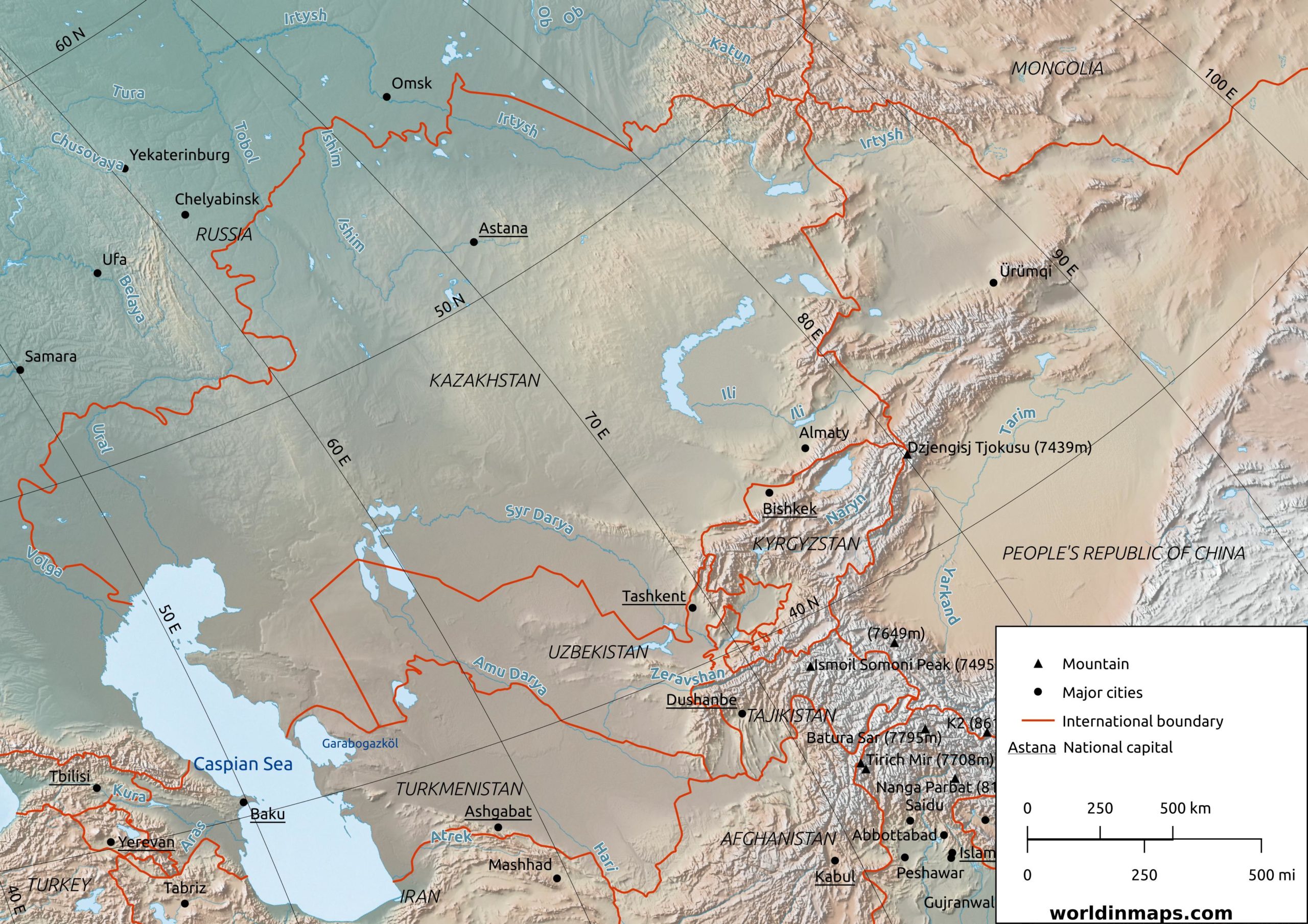
Physical map of Central Asia