Geography | Home / Geography / Polders
Polders
Polders are land reclaimed from water by population and it is most specifically associated with the Netherlands. Indeed, they have acquired through the century a very broad knowledge in this domain. Before we start to show how important they are for the Netherlands, we need to understand what they are and how they are made.
Table of contents
- What is a polder?
- How are polders made?
- Where are polders found?
- Polders in Bangladesh
- Polders in the Netherlands
- Why are Polders important to the Netherlands?
- Polders and dikes in the Netherlands
- The Delta Works
What is a polder?
A polder is an artificial tract of land reclaimed from water from marshes, estuaries, lakes or coastal areas. Most often the level of the tract of land is lower than that of the sea.
How are polders made?
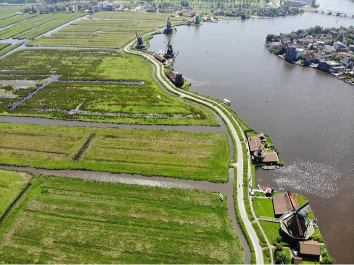
The surface to be developed is first surrounded by dikes. The water trapped between the dikes is then pumped. This was in the past operated by windmills equipped with a worm screw to raise the water to the sea, river or a channel. When this channel is also lower than the sea the water of the channel is also pumped into the sea with a windmill equipped with a worm screw. At the 19th century, these windmills were replaced by steam machines and by electrical and diesel motors in the 20th century.
The pumping of the water is not sufficient. To make the ground more dry, some plants, like reeds, are planted to dry up the ground.
To avoid the flooding of the polders by rain, a network of channels is built in the polders to drain all this water.
After the polder is built, the pump continues to work daily.
Where are polders found?
Polders are associate with Belgium and more notably with the Nederlands because a a substantial part of their area has been reclaimed from the sea over the centuries. But they are also found in Bangladesh, Canada, China, Denmark, Finland, France, Germany, Guyana, India, Ireland, Italy, Lithuania, Poland, Slovenia, South Korea, Spain, United Kingdom and United States.
Polders in Bangladesh
Bangladesh has 123 polders that are distributed along the sea (49 polders) and along the numerous distributaries of the Ganges – Brahmaputra – Meghna Rivers delta. These polders are recently built (in the 1960s) to protect the coast from tidal flooding and to reduce the salinity incursion for the agriculture.
Polders in the Netherlands
The Netherlands is frequently associated with polders because of their use across the centuries and their knowledge they have developed in this domain.
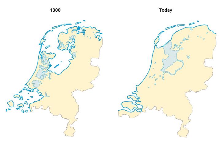
The Netherlands has started their conquest on land since the 13th century. 3 big periods of works can be distinguished. Between the 13th century and the 18th century, they have worked in the south and north of the country. Between the 18th century and all the 19th century the works where concentrated on the west of the country. And finally in the 21st century, they decided to build a full new province in the Zuiderzee, the Flevoland.
Why are polders important to the Netherlands?
The area of the Netherlands is 41 526 km², with 7 150 km² of polders, which represent 17% of the territories. In the beginning with the windmills, the soils were not dry enough for the agriculture and the polders where only use for breeding. After 1850 and the use of new technologies they managed to have the groundwater always at more than 1 m below the ground level of the polder which have allowed agriculture and the building of houses. Nowadays 60 % of the population the Netherlands lives on polders.
Polders and dikes in the Netherlands
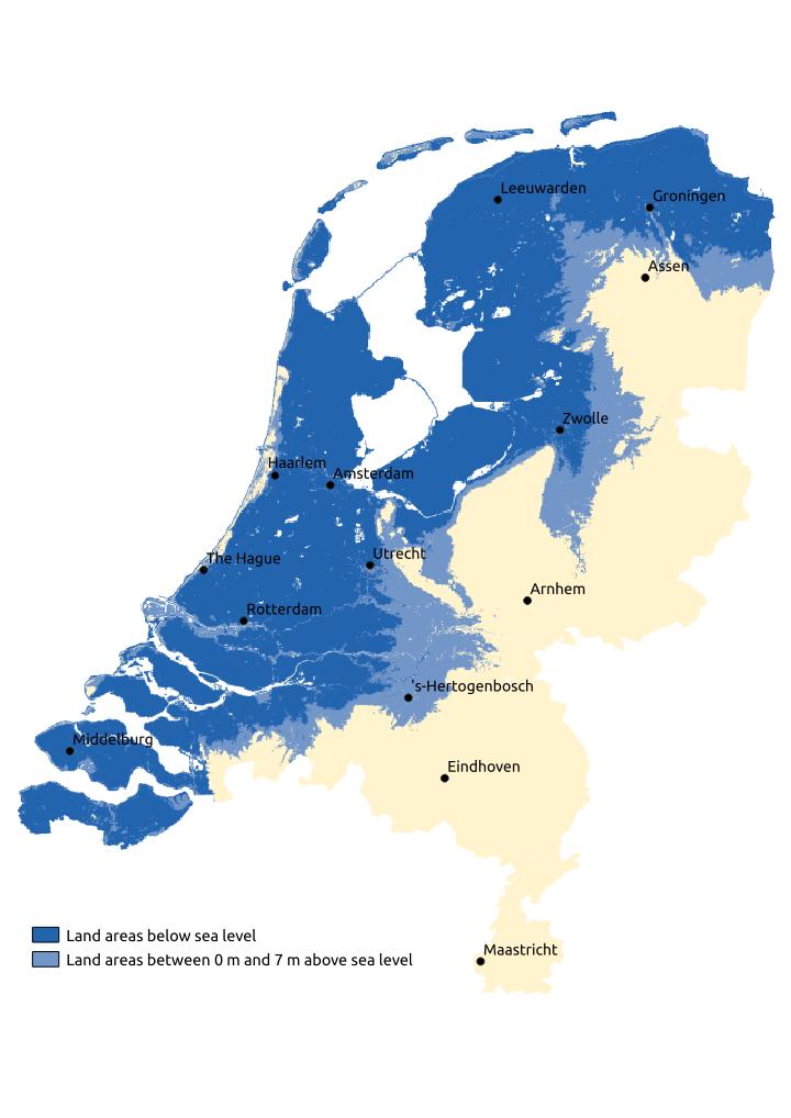
With this conquest over the sea a total of around 25% of the Netherlands are below the water level with a maximum of -6.76 m below the sea level, which is maximum for Europe. To protect these lands there are sand dunes all along the coastline. But these are not sufficient and dikes had to be built. Without these dikes, in times of high tide water would invade the land.
Another danger comes also from the rivers that have difficulties to flow down to the seashore because of the flatness of the Netherlands. If there where no dikes around these rivers, the water of the rivers will also invade the land.
Without all these infrastructures, more than the half of the country would be subject to flooding.
The Delta Works
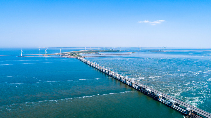
The Delta is a region of the south of the Netherlands, where the Rhine, Meuse and Scheldt flows into the North Sea. For a long period this region was very vulnerable because the sea could flood into the lands by using these 3 rivers like it has happened in 1953 and cause the death of 1800 persons. To avoid this to happen again, all the dikes were heightened to resist to a tide of 5m. But there was still 700 km of dikes to control. The government decided in the 1950s to close the inlets by building dams. These have bring to 25 km the dikes facing the sea, which is more easy to control.