The Danube River
The Danube River is one of the major rivers of Europe. With its length of 2 850 km (1 770 mi), it is the second longest river of Europe after the Volga. The Danube River flows through 10 countries, 4 capitals and its basin concerned 19 countries. Because of this and its central position in Europe, it is a very important strategic river. During the Cold War, the river was cut in two by the iron curtain and its development was limited. But since the fall of the USSR, it has entered a new era, even though some constrains still remains, and slowing down the economic development, the future of this major river seems to be bright.
Danube River Map

Where is the Danube River located?
The Danube River is the second longest river of Europe, after the Volga that flows entirely in Russia. The Danube structures the Central Europe. With a length of 2 850 km (1 770 mi), it flows from the black forest in Germany to the Black Sea.
What countries does the Danube flow through?
The Danube flows through 10 countries and 4 capital cities, which is a world record. The countries that the Danube cross or run along are from source to mouth: Germany, Austria, Slovakia, Hungary, Croatia, Serbia, Bulgaria, Romania, Moldova for only 400 m (0.25 mi) and finally Ukraine.
The 4 capital cities are Vienna (Austria), Bratislava (Slovakia), Budapest (Hungary) and Belgrade (Serbia).
If we take all the Danube basin into account, 19 countries are in total concerned. Above the 10 countries listed above, we have Bosnia and Herzegovina, the Czech Republic, Slovenia, Montenegro, Switzerland, Italy, Poland, North Macedonia and Albania.
Key facts
| Countries | Germany, Austria, Slovakia, Hungary, Croatia, Serbia, Bulgaria, Romania, Moldova and Ukraine |
| Major cities | Ulm, Ingolstadt, Regensburg, Linz, Vienna, Bratislava, Budapest, Novi Sad, Belgrade, Drobeta-Turnu Severin, Ruse, Brăila and Galați |
| Main source | Breg |
| Location | Furtwangen im Schwarzwald (Germany) |
| Elevation | 1 078 m (3 537 ft) |
| Secondary source | Brigach |
| Location | St. Georgen im Schwarzwald (Germany) |
| Elevation | 940 m (3 080 ft) |
| Source confluence | |
| Location | Donaueschingen (Germany) |
| Elevation | 686 m (2 251 ft) |
| Mouth | Black Sea |
| Location | Danube Delta (Romania and Ukraine) |
| Elevation | 0 m (0ft) |
| Length | 2850 km (1 770 mi) |
| Basin size | 801 463 km² (309 447 sq mi) |
| Discharge | At the Danube Delta |
| Average | around 6 500 m³/s (230 000 cu ft/s) |
| Minimum | 1 790 m³/s (63 000 cu ft/s) |
| Maximum | 15 900 m³/s (560 000 cu ft/s) |
Major cities on the Danube river
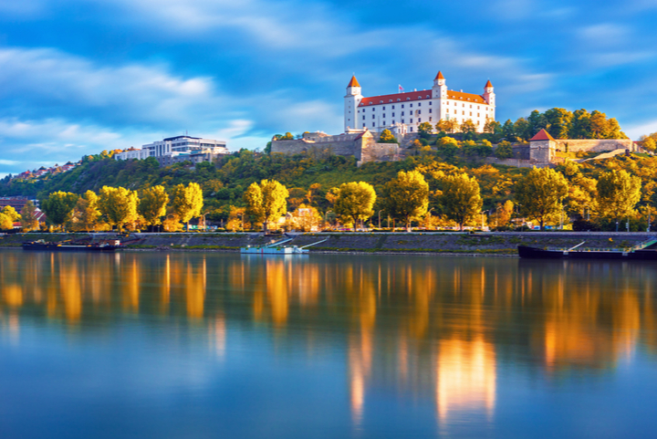
The Danube River has for long been an important trade route and it is therefore not surprising to have numerous cities along the river. The following major cities are located on the Danube: Vienna, Bratislava, Belgrade and Budapest. These major cities are capital cities of their respective countries. It is worthy to note that the Danube basin has six more capital cities: Bucharest, Sofia, Zagreb, Ljubjana, Sarajevo and Pristina. It is also interesting to note that Munich (capital city of Bavaria in Germany) is also located in the Danube basin. This latter is the fourth-largest city in the basin.
Geography of the Danube
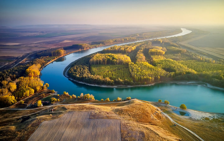
The Danube river is divided into three main sections. These parts are separated by “gates” where the river cuts through mountainous regions. The section between the sources and the Devin Gate, correspond to the Upper Basin. Then the Middle Basin (also called the Pannonian Basin or Carpathian Basin) is located between the Devin Gate and the Iron Gates. Finally, the last part is called the Lower basin and it runs from the Iron Gates to the river mouth and the Danube Delta.
The Danube Delta
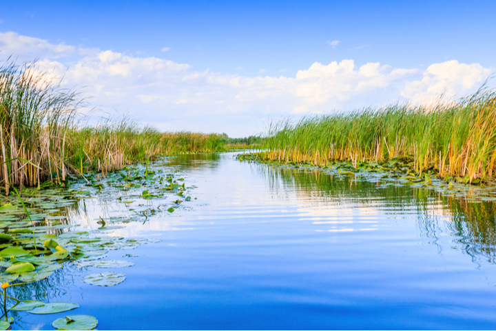
The Danube Delta corresponds to the mouth of the Danube River into the Black Sea. It is located in Romania and Ukraine. The Delta has an area of 4 152 km² (1 603 sq mi) and it is the second largest delta of Europe after the delta of the Volga. The Delta is a protected natural region and it is listed on the World Heritage Site by the UNESCO.
The Iron Gates
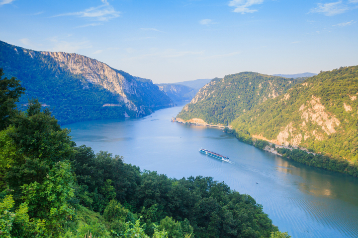
The Iron Gates correspond to the section of the Danube that divides the Carpathian Mountains in the north and the Balkan Mountains in the south. This section of the Danube corresponds also to the border between Romania and Serbia. The Romanian side corresponds to the Iron Gates Natural Park while the Serbian part is composed of the Derdap National Park.
The Iron Gates are 135 km (84 mi) long and it starts at the village of Bazias until the municipality of Drobeta-Turnu Severin. The width of the river varies from 2 km (6500 ft) until less than 150 m (500 ft).
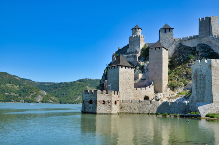
The Iron Gates have a very rich history. They are the location of one of the oldest sedentary villages of Europe (dating from the Paleolithic). On the river is also located the Roman memorial plaque “Tabula Traiana” which is 4 meters (13ft) wide and 1.75 m (5.75 ft) high and is dedicated to the Emperor Trajan. The impressive medieval Golubac Fortress is also located in the Iron Gates gorge.
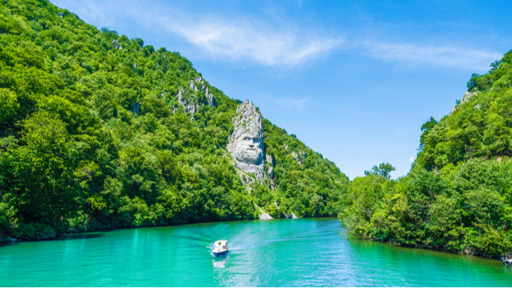
Near the Roman memorial plaque “Tabula Trajana” is also located an impressive rock statue of the face of King Decabalus, the last king of Dacia. The statue is 55 m (180 ft) height. The rock statue was sculpted between 1994 and 2004.
Economic importance of the Danube
The Danube occupies a big part of Central Europe. With its basin size of 801 463 km² (309 447 sq mi), the basin of the Danube counts for as huge as about 20% of the total area of Europe. This basin is located in 19 countries and concerned 80 Million peoples. These impressive numbers give directly an overview of the economic potential of the Danube and its strategic importance for Europe.
But for long the Danube River was separated in two by the iron curtain during the Cold War, cutting in 1949 the Danube in two between Vienna and Bratislava. The main part of the river was located on the Soviet side. During this period the Danube was mainly used by the USSR for importing wood and cereals and to furnish coal and oil to the Hungarian steel industry.
With the end of the USSR in 1989, the Danube has entered a new era and it has become again navigable on 85% of the river. This new economic era was also helped by the enlarging of the European Union in 2004 with countries located on the Danube. But some obstacle still remains. Germany, Austria and Slovakia are part of the European Union, the Euro currency zone and Schengen. Hungary has not the Euro currency. Croatia, Bulgaria and Romania haven’t the Euro currency and are also not part of Schengen. Finally, Serbia, Moldova and Ukraine have not the Euro currency, are not part of Schengen, but they are also not part of the European Union and they are still awaiting for their adhesion.
Nowadays 69 million of tonnes are transported each year on the Danube, but the potential and the interest on this river for the future is very high. China is, for example, investing in infrastructure on the Danube and it will not be surprising that the number of tonne transported on this river will continue to grow in the future. A unification of the countries of the Danube for the Euro currency, Schengen and their membership in the European Union would of course be a definite advantage for accelerating the economic growth of this region.